
Mountains, Please
You’ve likely heard the John Muir sentiment “The mountains are calling and I must go.” Though originally penned in a letter to his sister in 1873, that attitude rings true for tens of thousands of people over 150 years later, both Americans and visitors from abroad. One increasingly popular location that you may have felt call in the past is the North Cascades of Washington State. An alpine landscape home to jagged peaks, expansive glaciers, pristine lakes, towering forests and dozens of species of native creatures, the North Cascades beckons outdoor enthusiasts to traverse its namesake highway, also known as Washington State Route 20. Stretching 436 miles across the top portion of the state, Highway 20 guides travellers from Discovery Bay on the Olympic Peninsula all the way to the Idaho border. Of this route, the section between Interstate 5 and State Route 97 is one of the biggest draws for summertime visitors to the area.
Many locals have familiarity with the North Cascades Highway, but to visitors from other states or countries, the traverse is wild and unknown. Social media groups see hundreds of queries from prospective visitors, looking for insider tips on where to go and what to see. These posts generate dozens of responses, but most posts end with just a general overview of the area or only a few specifics. Online travel guides and magazine articles also have their limits, often lacking a comprehensive guide to the area. Fortunately for you, I have lived, recreated and worked in the North Cascades region for my entire life, and have put together this all-inclusive guide to the North Cascades Highway.
Note this write-up is quite extensive, so feel free to jump down to a specific area to find what you are looking for. Below, I will introduce you to the following, in this order: North Cascades National Park, east of the park to Winthrop/Twisp, west of the park including Baker Lake, the Skagit Valley, Anacortes & San Juan Islands, and Deception Pass/Whidbey Island. Some of the info will be links to more in-depth articles I provide on specific areas, or hike descriptions from Washington Trails Association.
- Marblemount
- Cascade River Road
- Newhalem
- Skagit River Gorge
- Colonial Creek/Diablo Lake
- Eastern Edge NCNP
- Washington Pass
- Methow Valley
- East of Twisp
- West of Marblemount
- Baker Lake
- Skagit Valley
- Samish & Swinomish Flats
- Anacortes & The San Juan Islands
- Deception Pass & Whidbey Island
- Port Townsend
- Mount Baker Highway
- Lake Chelan
North Cascades National Park
Perhaps the foremost draw to the area, visiting North Cascades National Park is actually a bit of a conundrum. You may have seen articles claiming it is the 2nd least visited national park, and think that means you’ll encounter nothing but solitude and bears on your visit. In reality, only about 5% of the people who go to North Cascades *actually* enter the park boundaries, as the true park is only accessible via hiking or driving Cascade River Road. The remaining 95% of visitors spend their time in Ross Lake National Recreation Area, which includes the campgrounds, overlooks and visitor center. In 2024, Ross Lake NRA saw over 970,000 visitors (an increase of 10.1% from 2023) while North Cascades National Park only had 16,484 visitors (a drop of 59% due to lack of accessibility due to wildfires). Of the Ross Lake visitors, the vast majority (over 626,000) entered from the west, with over 166,000 stopping at the visitor center (a 27.5% increase YOY). 2025 is already seeing more traffic than last year, with an increase already of 9.3% at the visitor center during the month of June.
Marblemount
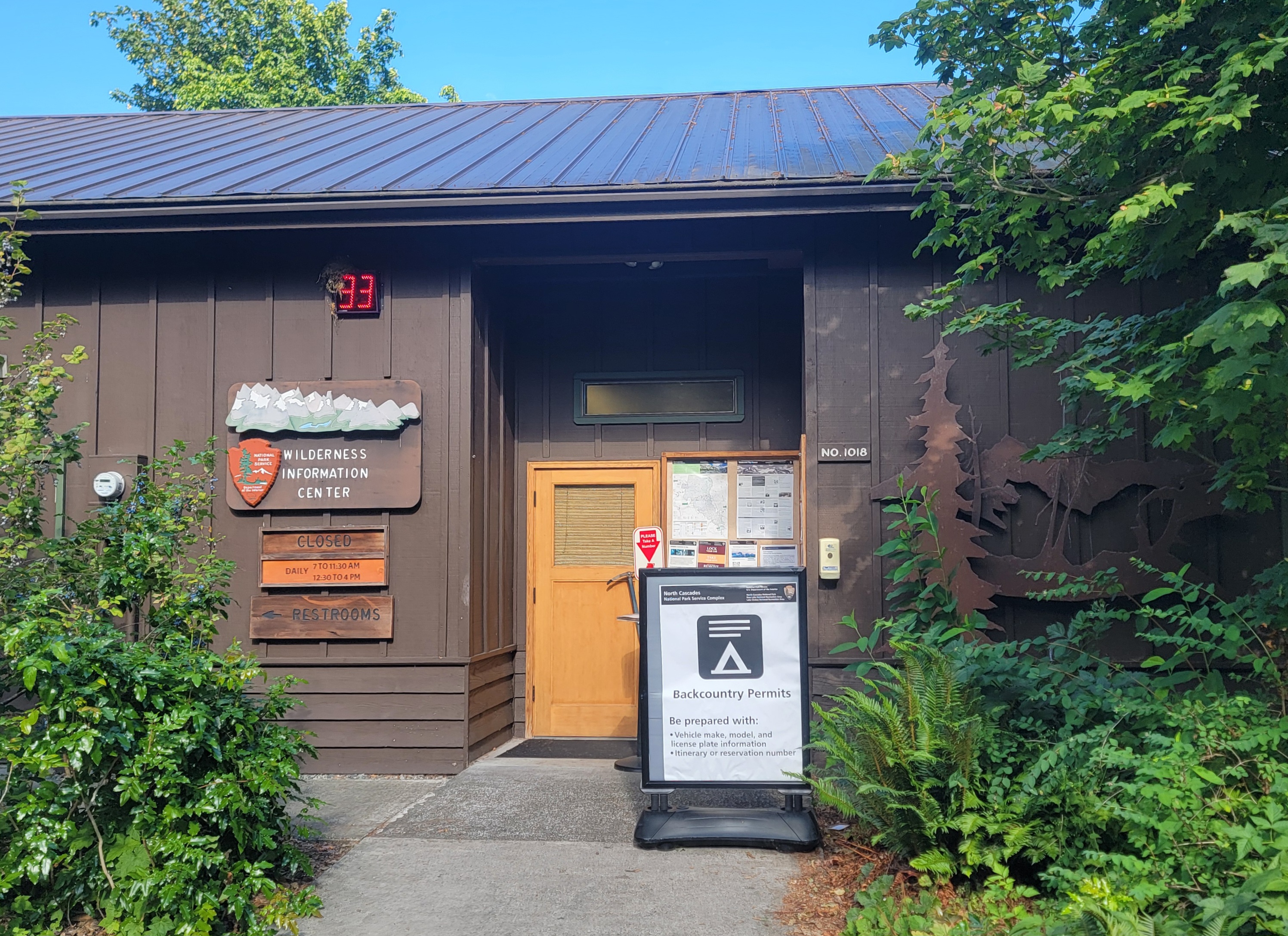
When accessing the park from the west, the town of Marblemount is the proverbial fork in the road, where you can choose two entrance options. The most popular is to stay on State Route 20 toward Newhalem, while others opt to drive Cascade River Road, which provides access to popular hiking areas. North Cascades National Park Service Complex is a “fee-free” park with no entrance station and no dashboard permit required, however, trailheads within US Forest Service lands do require a either a Northwest Forest Pass or a federal interagency pass (If you intend to visit more than a couple federal sites during the year, I recommend the America the Beautiful Pass, which provides access to all federally-managed sites for one year).
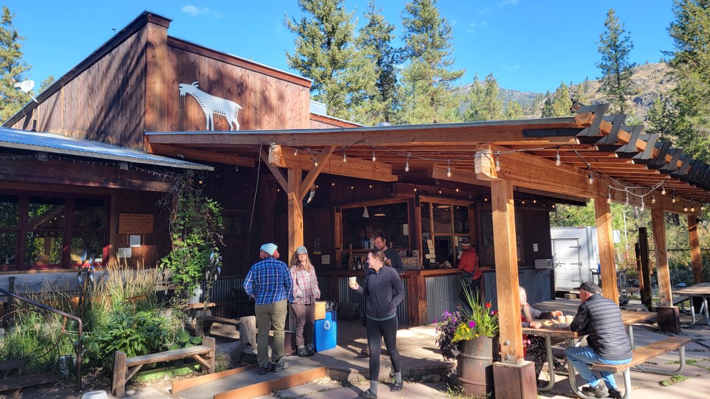
In Marblemount, NPS staffs the Wilderness Information Center, which provides park information, maps, gifts, restrooms and permits for backcountry camping. The town itself is very small, with 2 restaurants, 2 gas stations, an espresso stand, a small inn, a couple private campgrounds and a couple other small businesses. Gas is often at premium pricing here, so fill up closer to Interstate 5 if you want to avoid sticker shock. My personal experience at the restaurants has only been so-so, so while I cannot personally recommend them, they get the job done after a long day in the park.
Cascade River Road
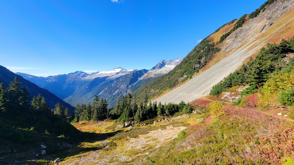
Cascade River Road is 23 miles long, with the first 10 being paved. The remainder usually is in fairly decent condition, with a handful of rough areas. It closes at MP 20 each winter, and often is not accessible beyond there until July. When open to the very end, expect the journey on this road to take around an hour. The reward at the end is spectacular mountain and glacial views from the parking lot, and the trailhead to the very popular Cascade Pass, a 7-mile (round trip) trail that provides stunning views of many Cascade peaks, plus beautiful wildflowers in the summer and an explosion of color in autumn. It is also a hot spot for seeing black bears and mountain goats. On weekends, the lot fills up early; even during the week this trail sees a significant amount of hikers.

Other popular hikes that can be accessed from Cascade River Rd include Lookout Mountain and Monogram Lake, with the former being outside National Park boundaries, and the latter inside the park. Both are accessed from the same trailhead, 7 miles from Marblemount. A few miles further is the turnoff to access the trail to Hidden Lake Lookout, situated right on the border of the park, with immersive views deep into the heart of the Cascades. The forest road to the trailhead is steep and rough; high clearance and 4-wheel drive are recommended. All 3 of these hikes are steep and arduous, each gaining somewhere around 1000’ per mile.
Newhalem
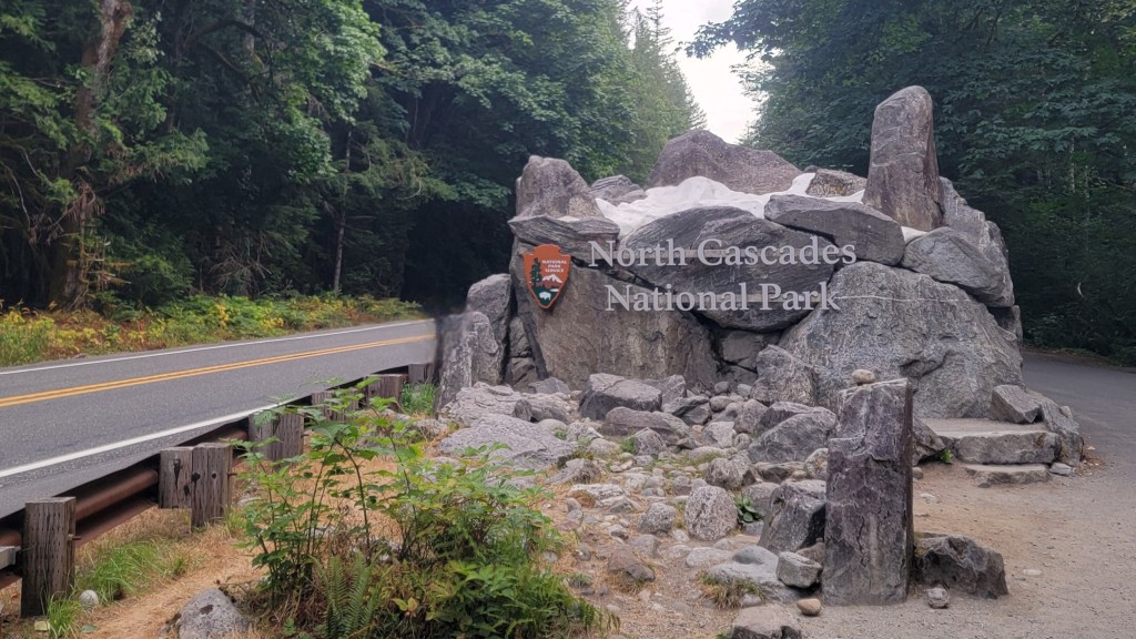
Heading toward Newhalem from Marblemount, the highway twists and turns for several miles with periodic views of the deep green and blue Skagit River. Please be courteous to other drivers, and use the numerous pull-outs to let other vehicles pass when taking in the scenery. The official entrance sign is just before MP 112, and provides a pull-off area and great group photo-op in front of a mountainous structure complete with fake “snow.” Please do not use this area for a restroom break or toss your trash, as full facilities are only a few miles up the road.
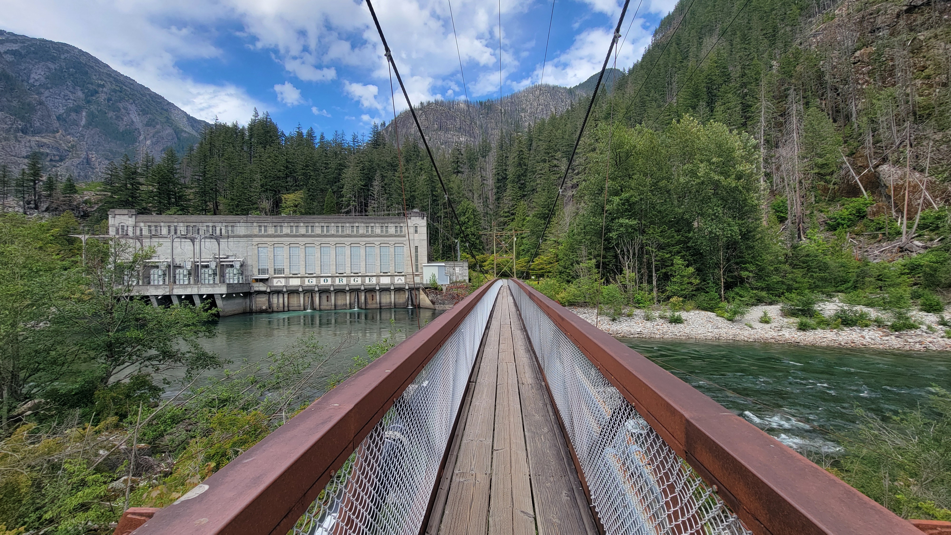
Just a few minutes later, arrive in Newhalem, the last stop for full services until you are over the pass and in Mazama. Newhalem is a “company town” operated by regional utility Seattle City Light, which operates 3 hydroelectric dams along the Skagit River to the east of here. Along with ample parking and electric car charging stations, Newhalem offers restrooms, a small general store, an information center with a gift shop, and a historic train locomotive displayed near the highway. Please follow the posted 30 mph speed limit (strictly enforced) along the stretch of SR 20 through Newhalem, and watch for pedestrians. From the town, you can access a short walk/hike at Ladder Creek Falls adjacent to the Gorge Powerhouse.


As you enter Newhalem, the turnoff for the North Cascades National Park Visitor Center is well marked. Cross the bridge, go through the stop sign, and find the building at the end of the road. Posted speed limit is 10 mph through the entrance, and 25 mph up the hill and is enforced by NPS law enforcement. Be mindful of pedestrians and wildlife. The Visitor Center offers clean restrooms during business hours, an information counter, bookstore, museum and theater, plus access to the Sterling Munro boardwalk and the River Loop Trail. Parking fills up quickly on weekends and holidays; please heed all parking signs and do not block access to RV parking.

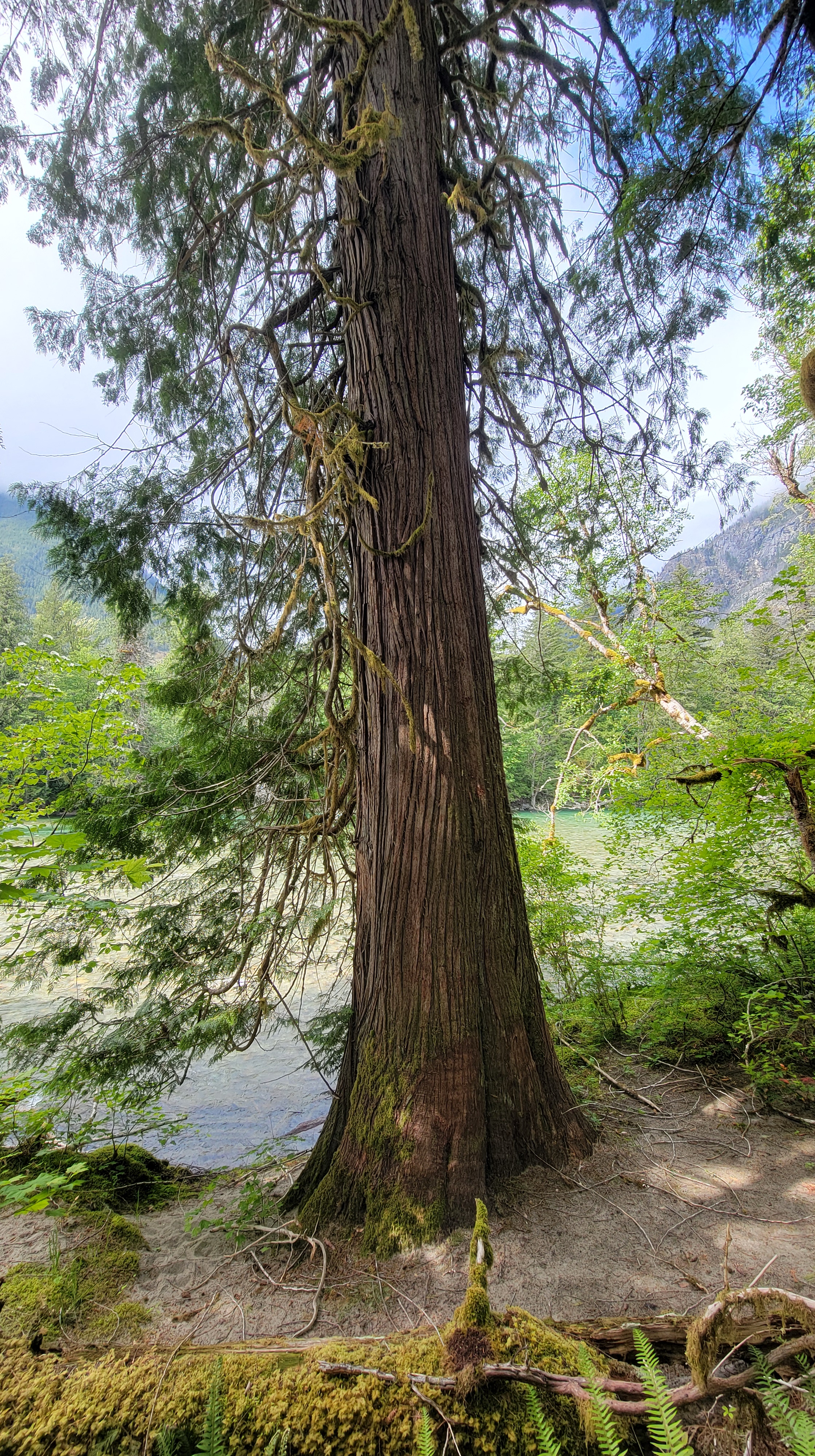
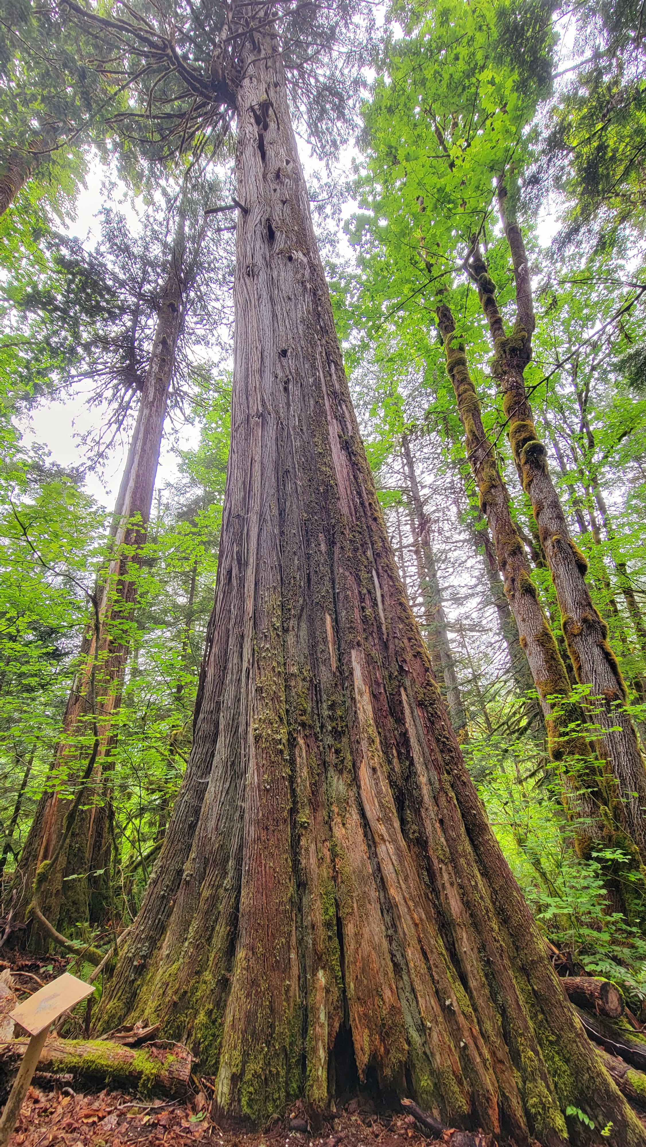
A short drive from the visitor center will take you to the Trail of the Cedars or one of my favorites, the Rock Shelter Trail, which provides a dynamic look at the regrowth and recovery from a devastating wildfire about 10 years ago.
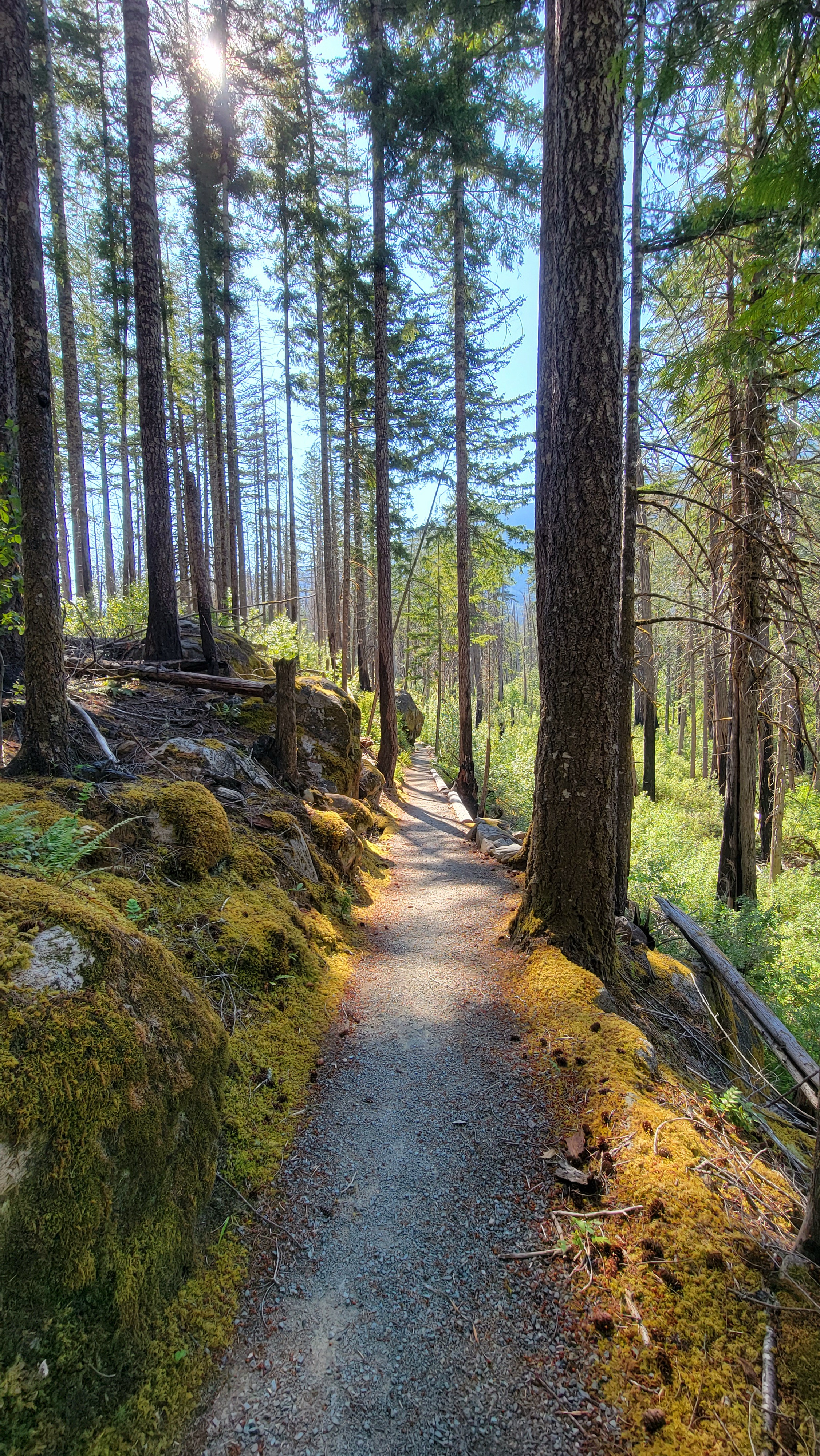

Another popular hiking option just west of town is Thornton Lakes/Trappers Peak with beautiful views and a tranquil lake. The 5-mile road to the trailhead is steep, rough and narrow in places, and gets progressively worse as the summer goes on. High clearance and 4-wheel drive is recommended. The trailhead has room for a handful of vehicles and a pit toilet that is serviced about once a week. Please ensure you are not blocking the turnaround or the roadway when parking, and pack out all trash.
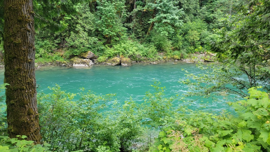
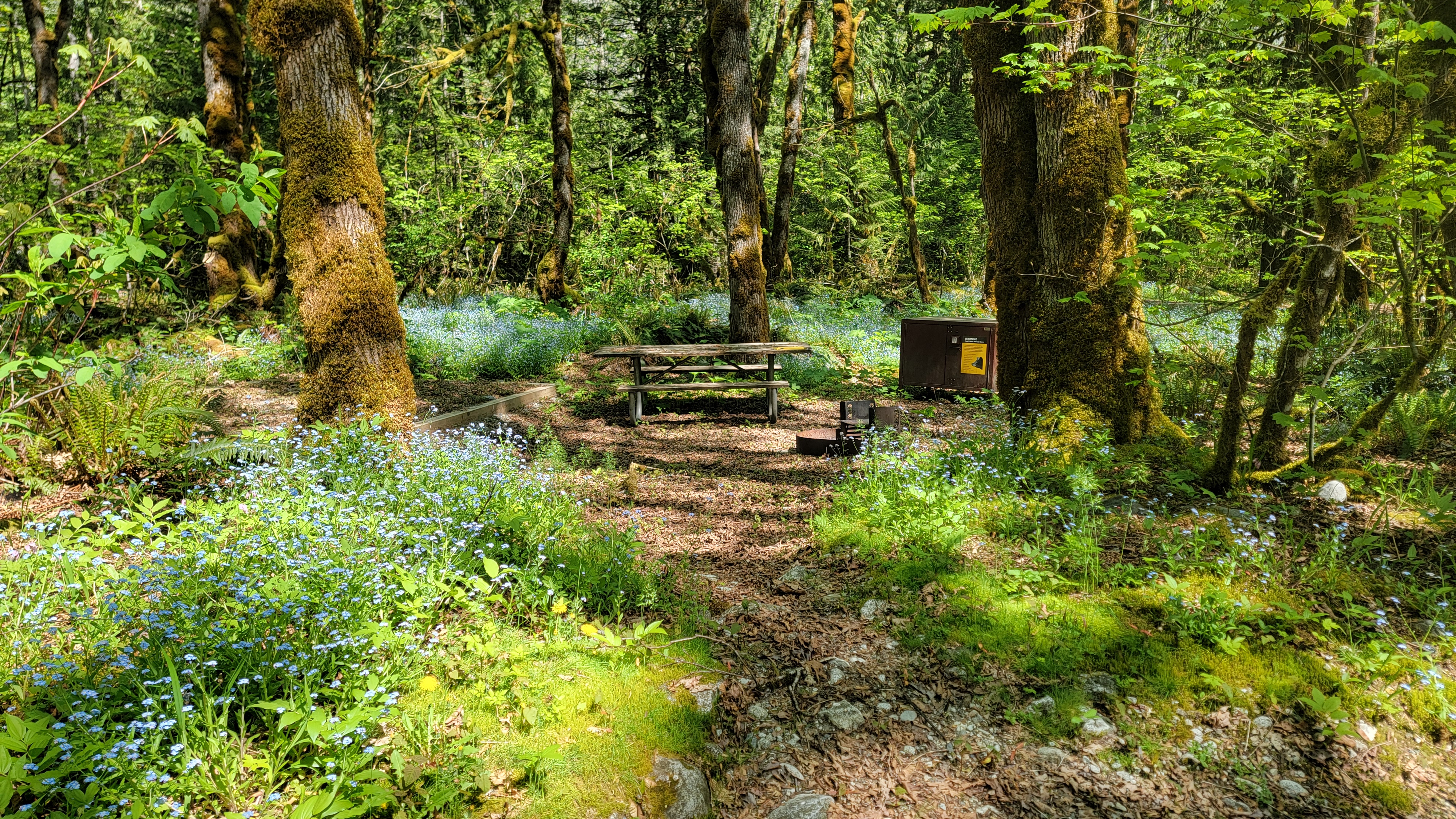
NPS also offers several camping options in Newhalem, with several dozen tent/RV sites in the Newhalem Creek Campground, with restrooms (no showers), potable water, and a camp host. Loops A and C are reservable up to 6 months out, with Loop B reservable up to 1 week out. During the summer, it is not uncommon for every site to be booked, and finding a site last minute can be challenging. There are also 2 large group sites available to reserve as well. Back across the river, the smaller Goodell Creek Campground has 19 semi-primitive campsites, with pit toilets and potable water. Sites are smaller and may not be accommodating of all sizes of RVs. Some sites provide paths to the rocky beach along the Skagit River. A raft launch next to the campground offers full access and is utilized regularly by private rafting companies and individual rafters alike (please keep the drive clear for vehicles to launch their craft).


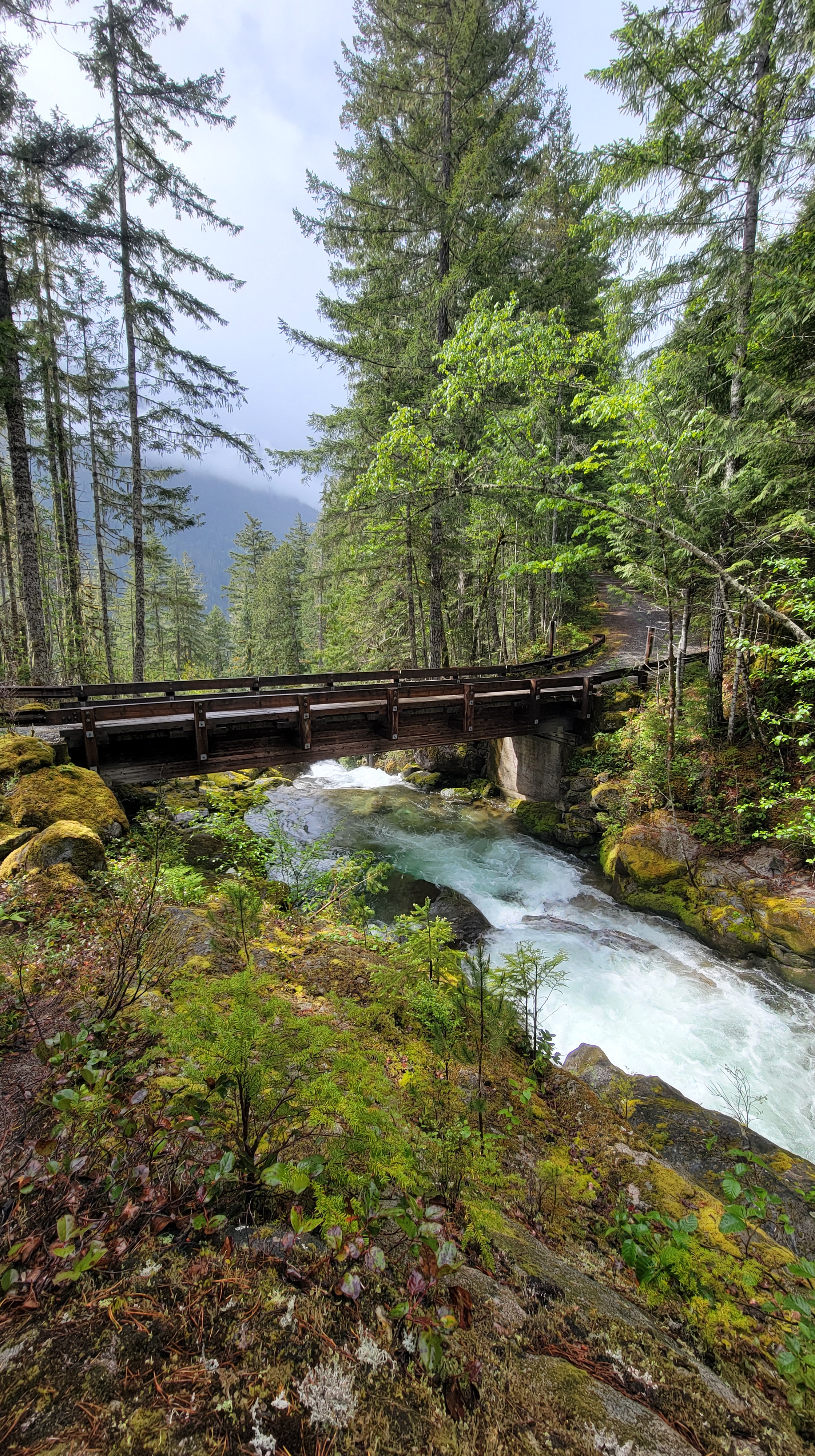
Skagit River Gorge
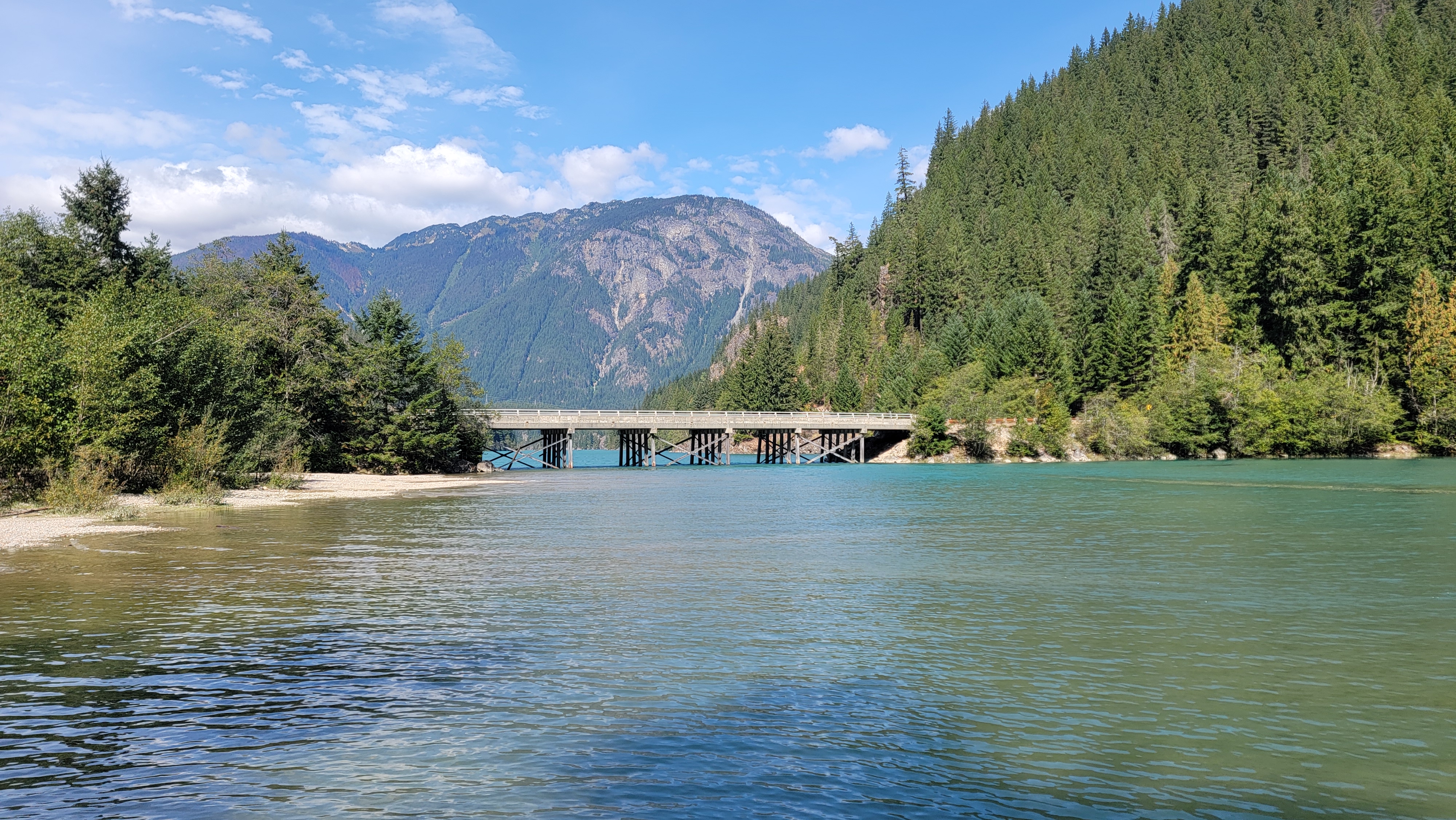
Heading east from Newhalem, enjoy stunning views as you wind through the narrow Skagit River gorge (again being mindful of the posted speed limit and other motorists, using the numerous turnouts to let others pass). Pull off at the parking lot for Gorge Creek Falls, and walk over the vertigo-inducing metal-grated bridge approximately 150 feet above the creek to view a 242-foot tall waterfall cutting through the cliff ahead of you. On the parking lot side of the road, a short walk provides peek-a-boo views of Gorge Dam. The parking lot here has regularly-serviced pit toilets.


Toward the east end of Gorge Lake, the turnoff to the Seattle City Light town of Diablo is closed until further notice, along with the Gorge Lake Campground and the Sourdough Mountain Trail. This closure is due to unstable hillsides in the aftermath of the 2023 Sourdough Fire. Evidence of the fire is visible along several stretches of SR 20. Just after the bridge, the trail to Pyramid Lake is short with a moderate climb to what is more of a pond than a lake. The hike winds through scenic stands of mixed forest, and the lake provides colorful reflections.

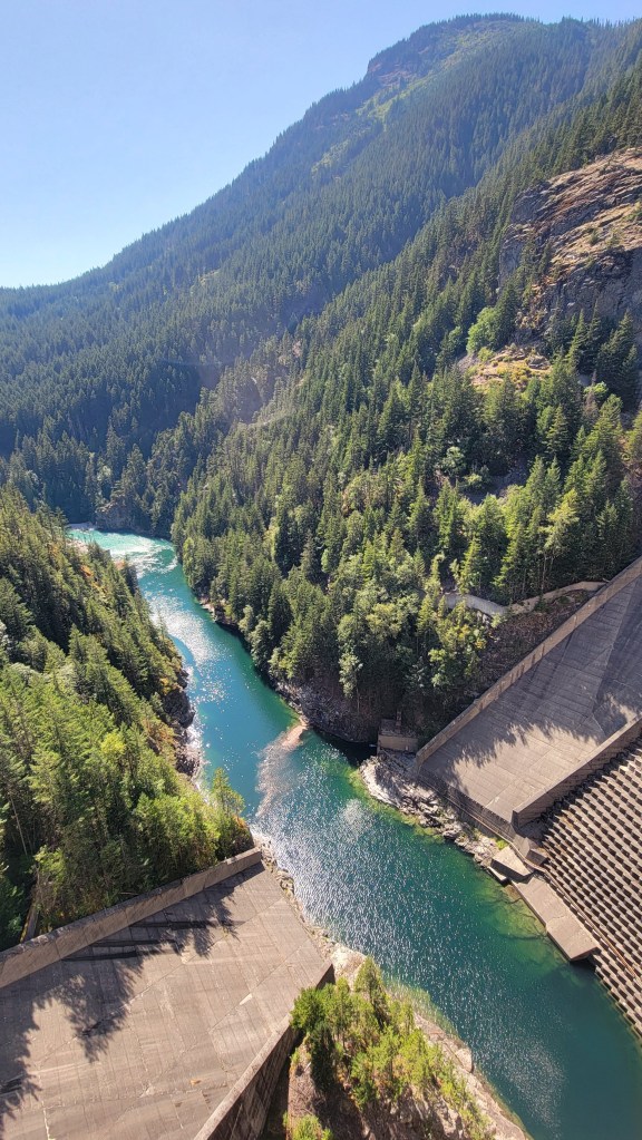
A short distance later, the turnoff to Diablo Dam and the Environmental Learning Center (ELC) operated by the North Cascades Institute. The dam is 389 feet high and spans 1180 feet. You can drive across the dam in your vehicle (yes, it is wide enough for two vehicles to pass, but be aware of large trucks); on occasion, the spillway is open, and walking across the dam offers great views of rainbows through the mist as the water crashes into the canyon below. The ELC offers youth educational programs, family outings, tours and group retreats. Adjacent to the campus, the Diablo Lake Trail provides periodic mountain and lake views high above Diablo Lake, while the Sourdough Creek Trail ventures a little under 2 miles to a scenic falls that provides welcome cooling mist on hot summer days (the scramble to the base of the falls can be loose or slippery).


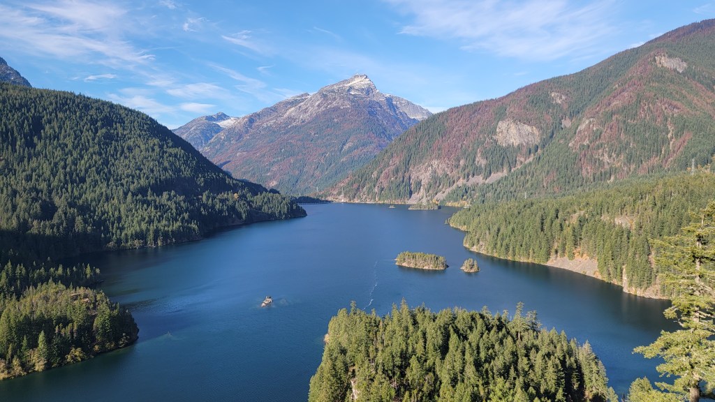
Colonial Creek/Diablo Lake
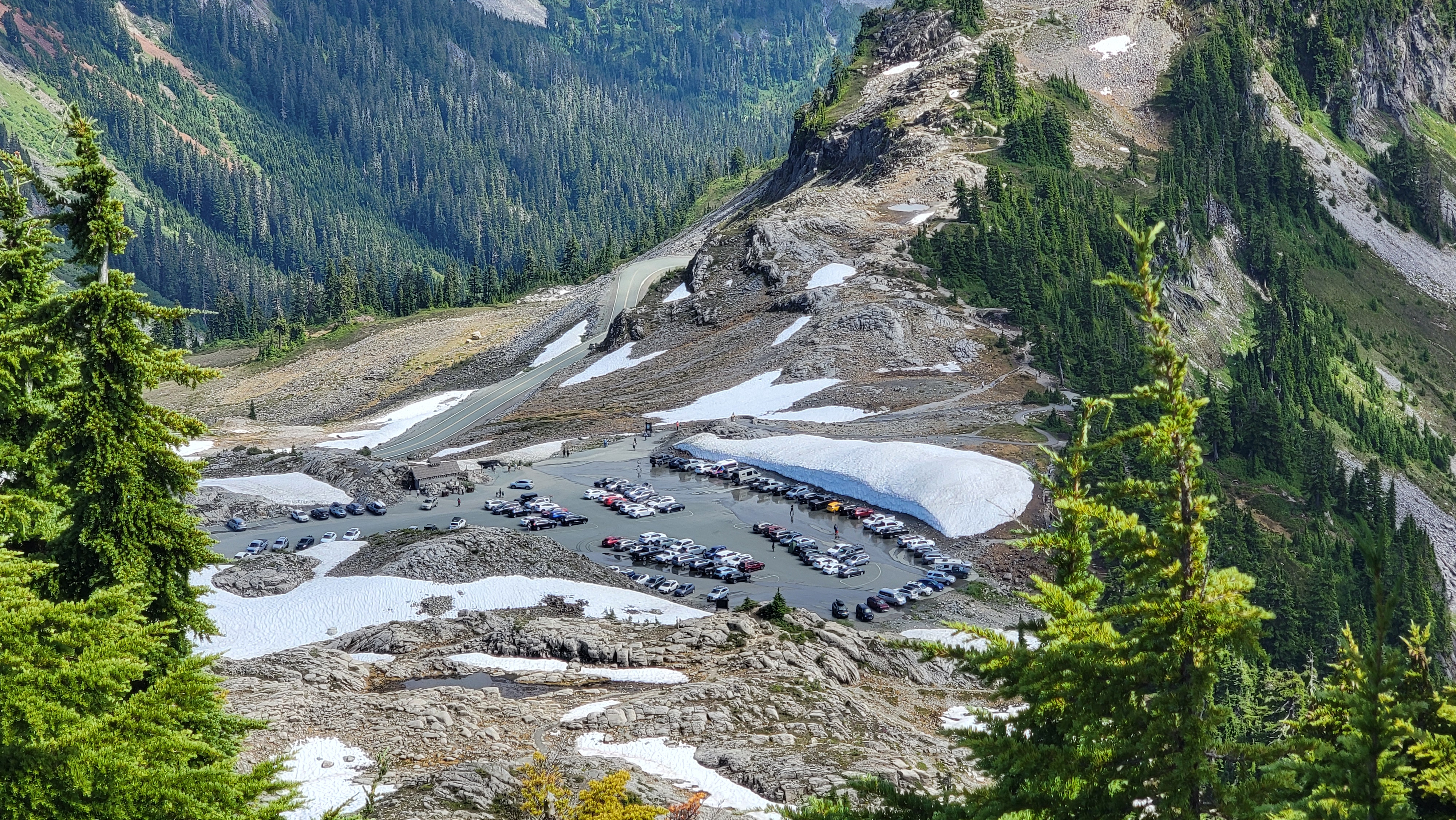
Another few miles east, Colonial Creek Campground has a north loop of 43 campsites (most reservable 6 months in advance) and a south loop with 93 campsites (some tent-only). Both loops offer restrooms with flush toilets and potable water. The north side of the highway provides a small parking area adjacent to Diablo Lake, with access to the beaches for swimming, paddling and sunbathing, while the south side has a larger parking lot and a boat launch (accessibility and conditions vary due to sediment and fluctuating water levels). This entire area fills up quickly during most of the summer, especially weekends and holidays; it is not uncommon for cars to be lining the highway over ¼ mile in each direction from the intersection at peak times, so please drive carefully and watch for pedestrians.
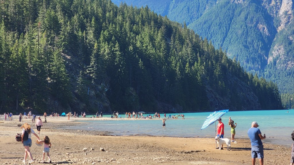

If you choose to paddle on the lake to take in the views and the distinct color, be mindful that breezes tend to pick up significantly in the afternoon, and can make the return trip strenuous and, at times, hazardous.
The north campground loop also offers access to the popular Thunder Knob Trail, a fairly short and simple hike that provides a 180-degree view of Diablo Lake and the peaks above; this trail sees a lot of foot traffic during peak season. The south loop provides access to the less-visited Thunder Creek Trail and connecting backcountry trails and campsites. The first couple miles provide a peaceful forest walk and a scenic bridge before entering more strenuous terrain.

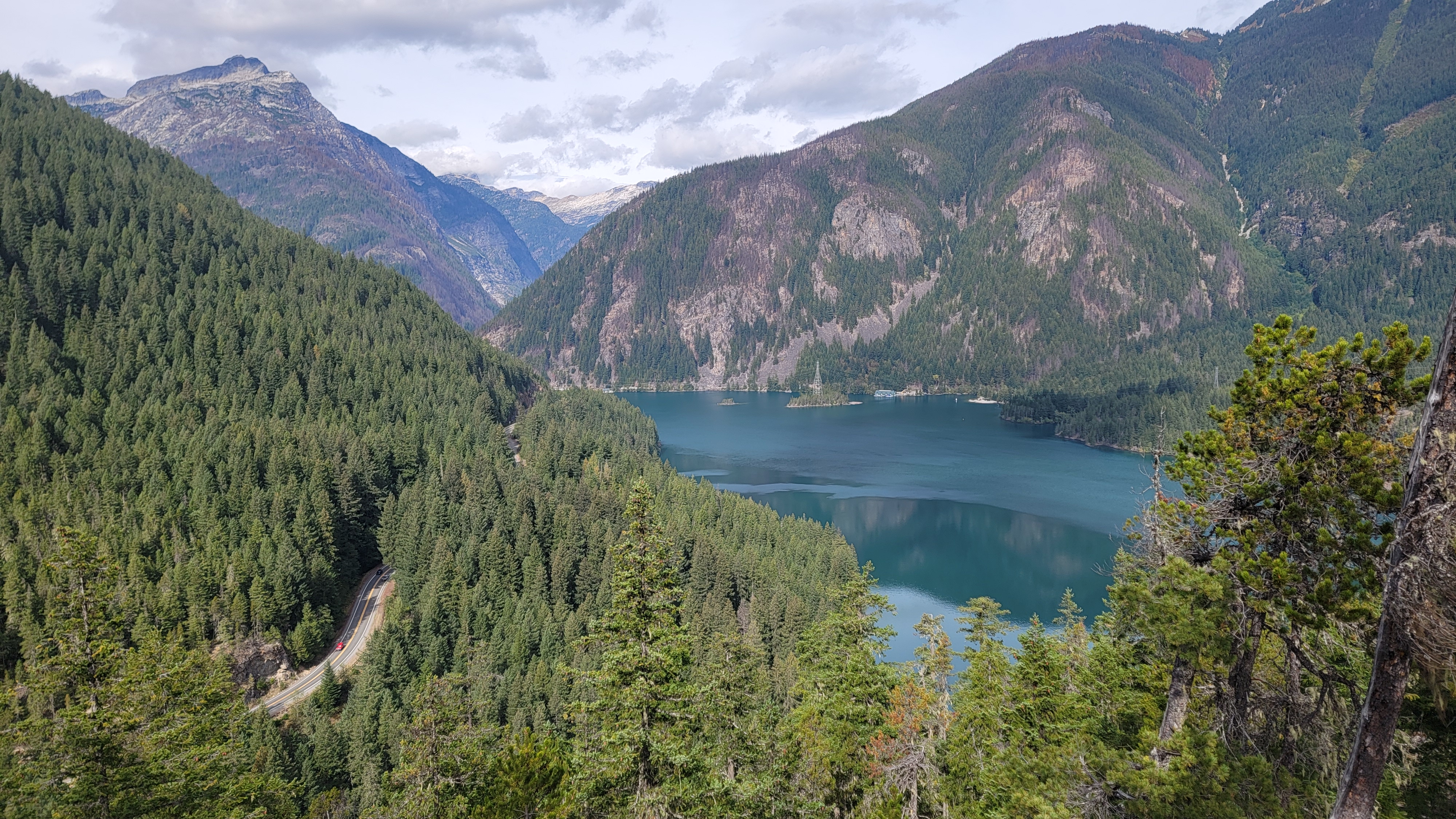

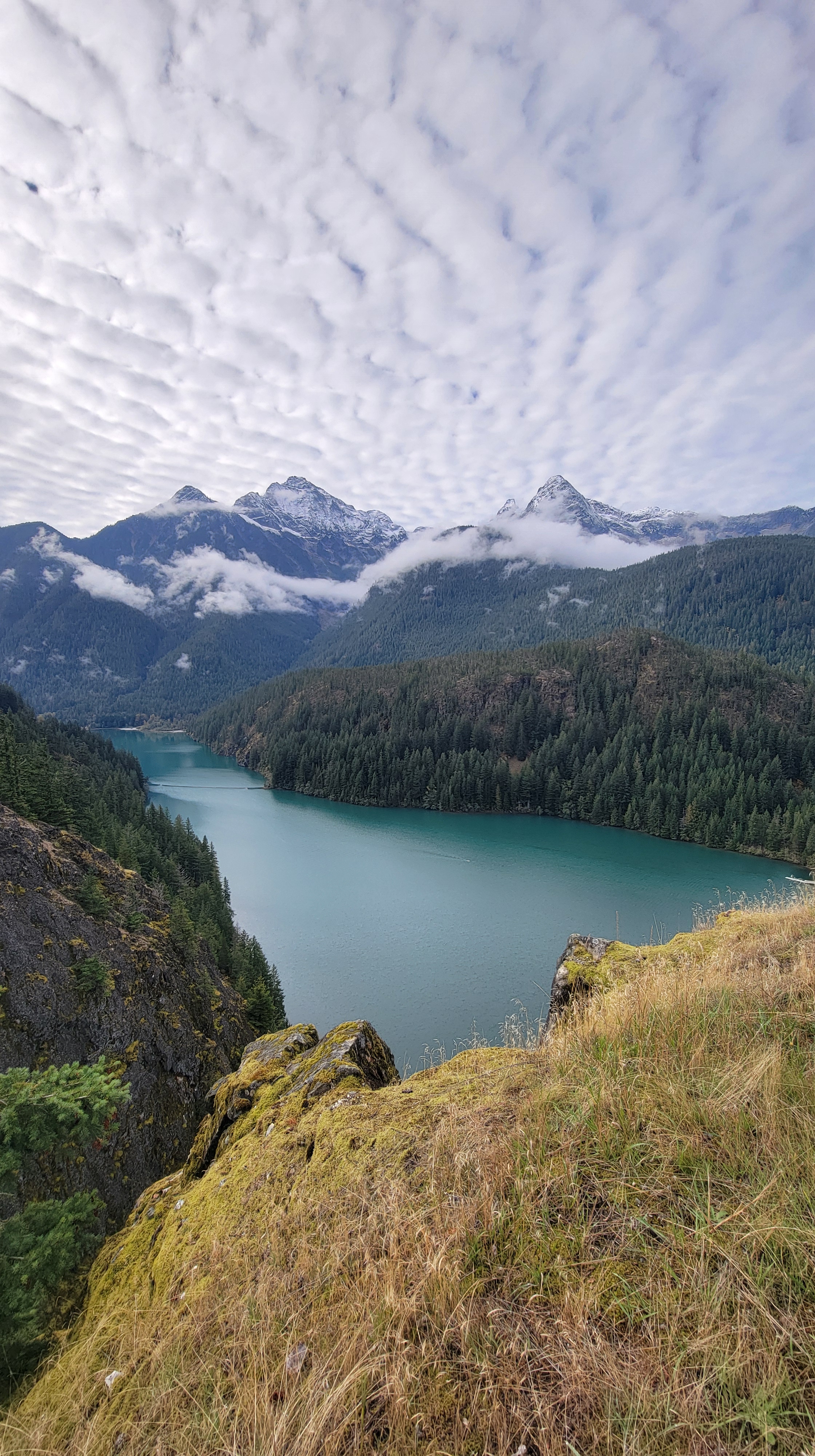
Back on SR 20, cross the bridge and drive up the hill to Diablo Overlook, one of the most-visited spots in the park and a common turnaround point for day-trippers. Just steps from your car, find gorgeous views over Diablo Lake and the towering heights of Davis Peak to the west, Sourdough Mountain to the north, and Colonial and Pinnacle Peaks to the southwest. The ever-changing color of the lake is mesmerizing, starting a deep blue in early spring and becoming a bright teal by mid-summer. The distinct summer color is due to the presence of “glacial flour,” which is comprised of fine rock particles deposited in the lake from seasonal glacial melt. There is a large parking lot for cars and RVs, plus picnic tables, 4 pit toilets, and trash dumpsters. While the facilities are addressed daily, due to the popularity of this overlook, restrooms can become messy fast and the trash can quickly overflow. If the receptacles are full, please pack out any trash you have, otherwise the local ravens will certainly tear into it and spread it around the lot.


Eastern Edge
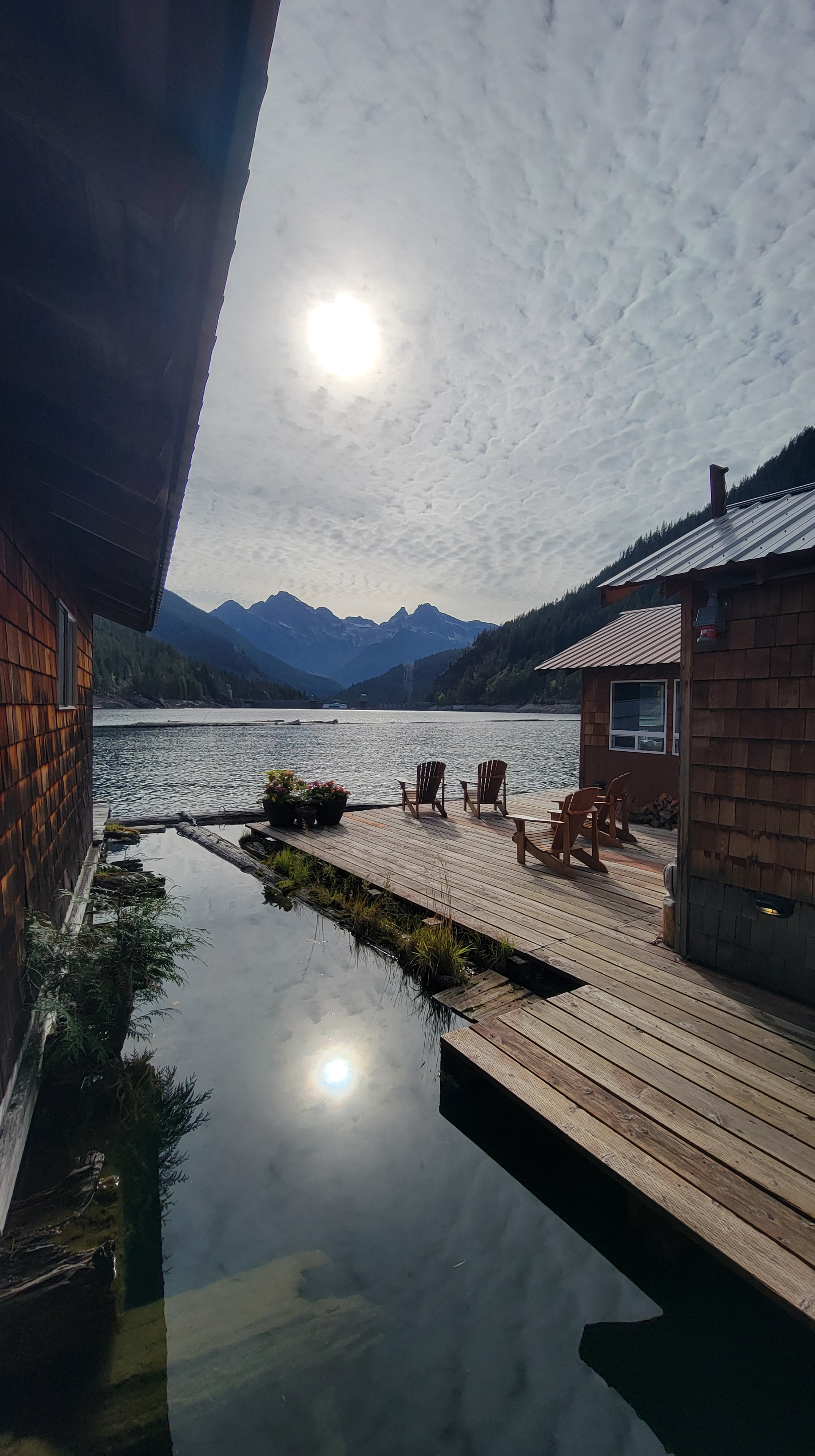
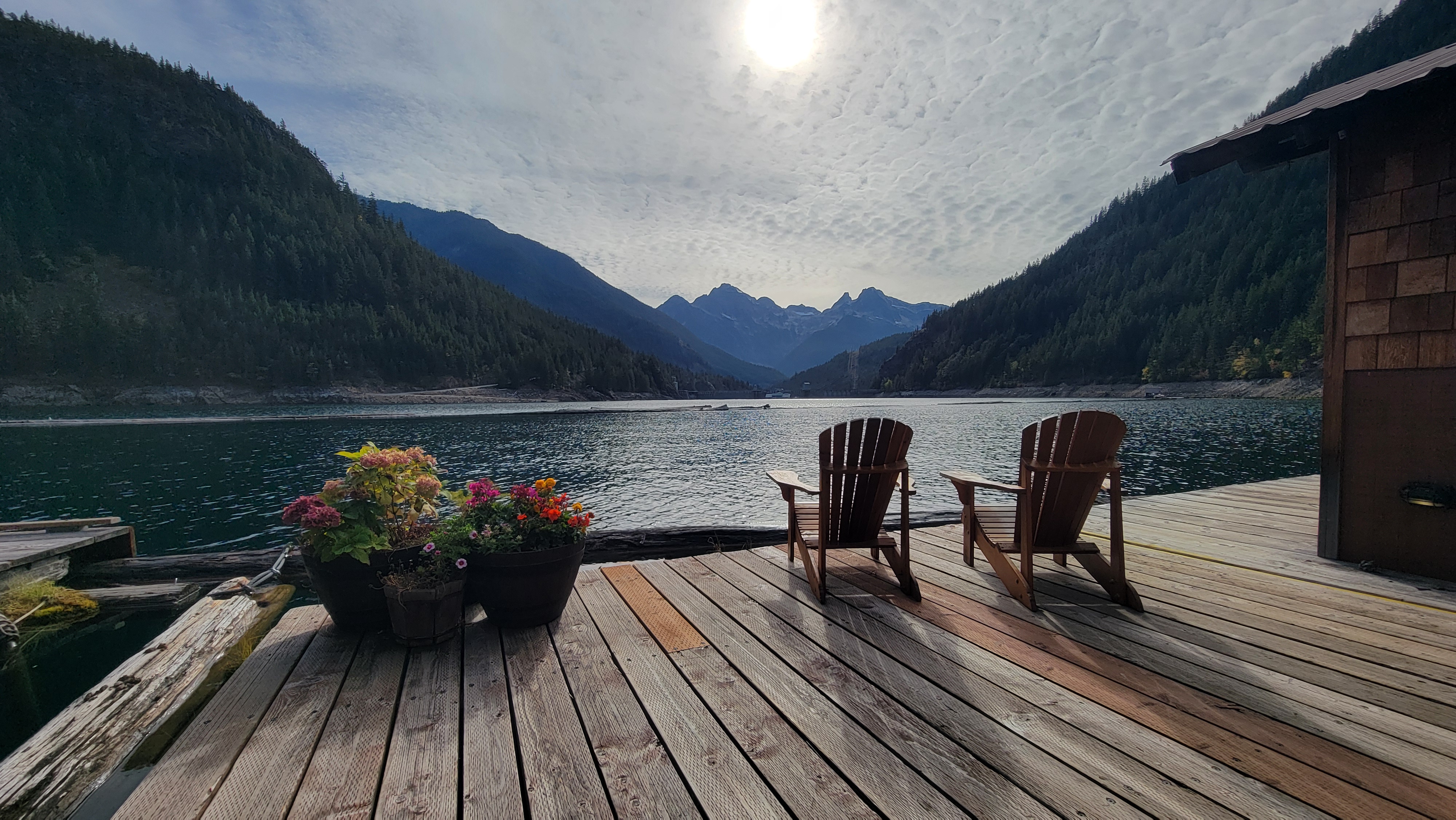
The last remaining stretch of SR 20 inside NPS boundaries features a few more small points of interest. At MP 134, find parking and access to the Ross Dam Trail, a short but steep drop to and across the 540-foot high Ross Dam, the largest of the 3 hydroelectric dams along the Skagit River. On the north side of the lake, the floating Ross Lake Resort provides a one-of-a-kind overnight stay, plus numerous recreation opportunities.
Less than a mile east of the Ross Dam lot, the Happy Creek Forest Walk provides an elevated boardwalk through a picturesque forest, with a longer option to a small falls and former site of a mill with a few mining relics (do not remove any of these). At the far east boundary of the park, the East Bank Trail stretches 30 miles along the eastern shore of Ross Lake, with periodic backcountry campsites and other connecting trails. If your day is getting short, turn around and head back west, or if you have the time or are on a multi-night drive, continue east; some of the most stunning views in the North Cascades are actually outside of the NPS boundaries!


Eastbound to Washington Pass
Not far beyond the East Bank Trailhead, SR 20 leaves NPS jurisdiction, though you’re now in the heart of the North Cascade Mountains. Surprisingly, some of the most spectacular views and hikes reside outside of the national park boundaries, falling instead under management of the U.S. Forest Service (all of these trailheads will require a Northwest Forest Pass or a federal interagency pass to park).
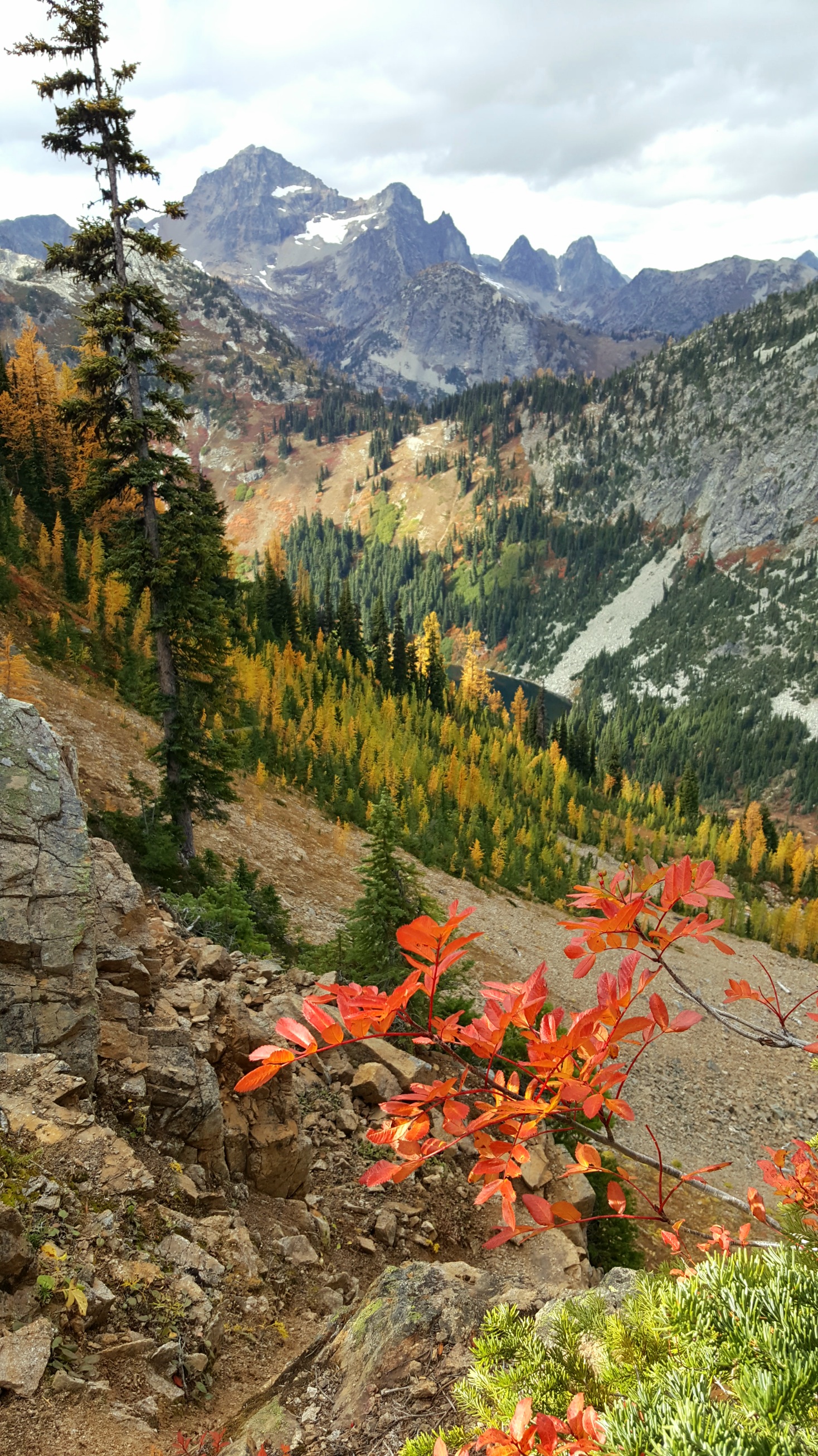
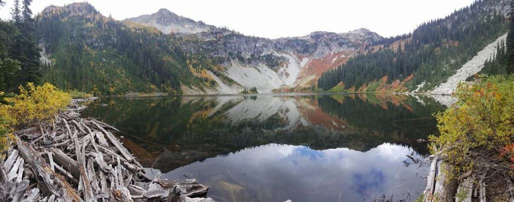
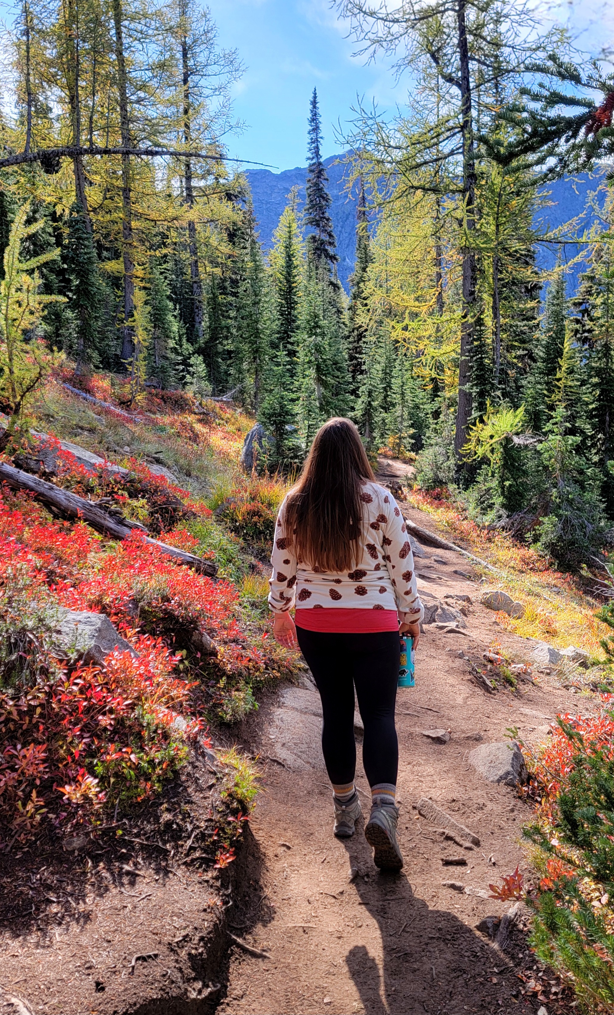
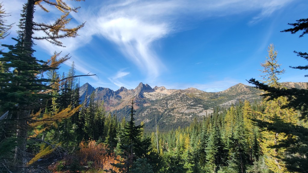
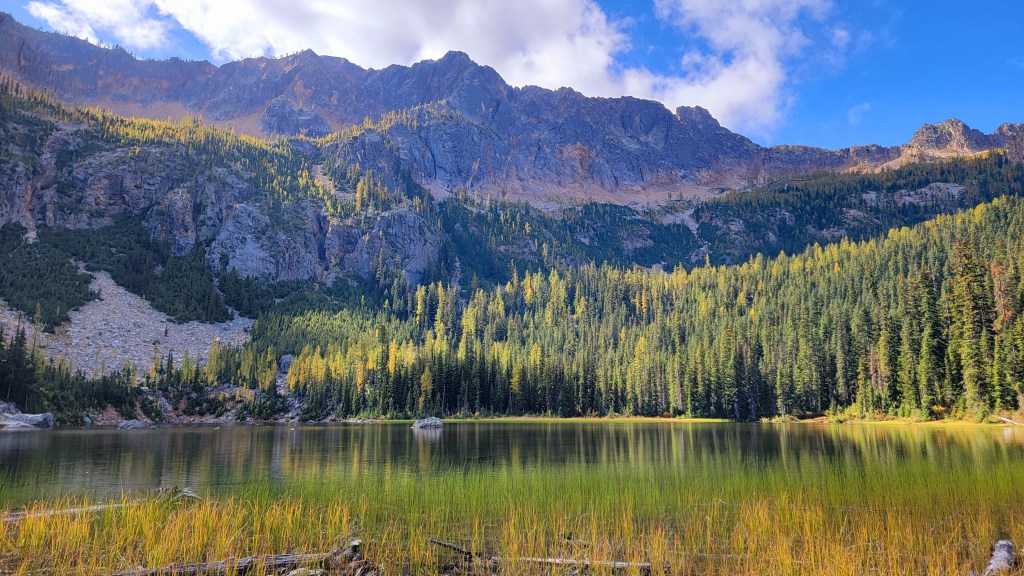
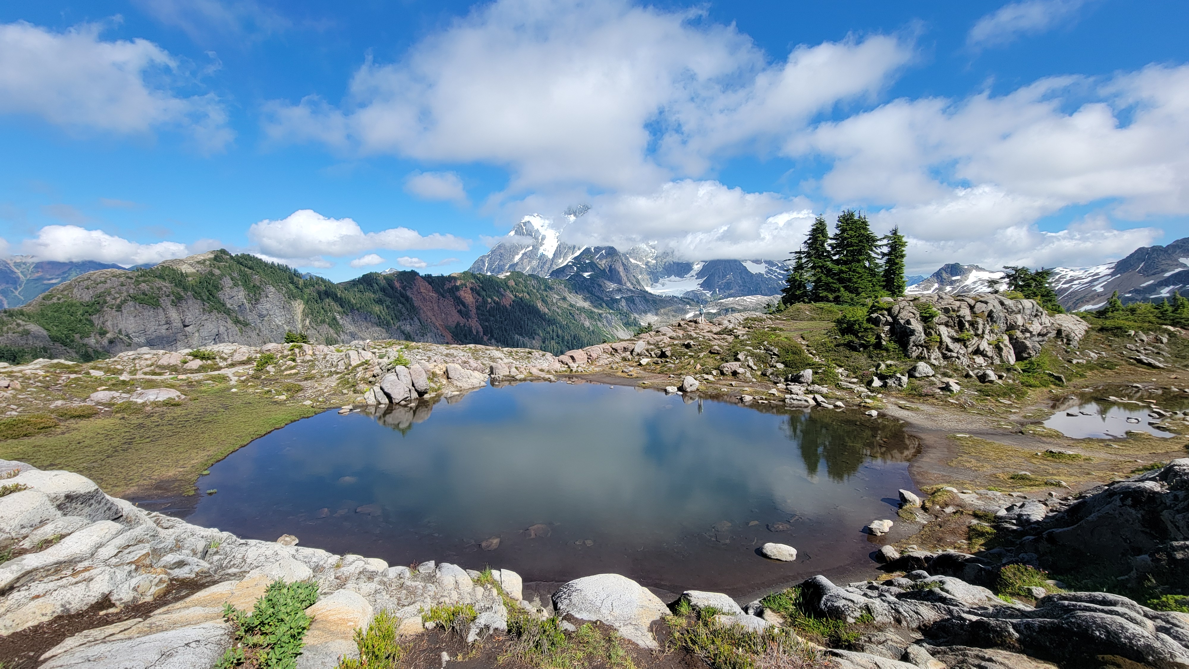
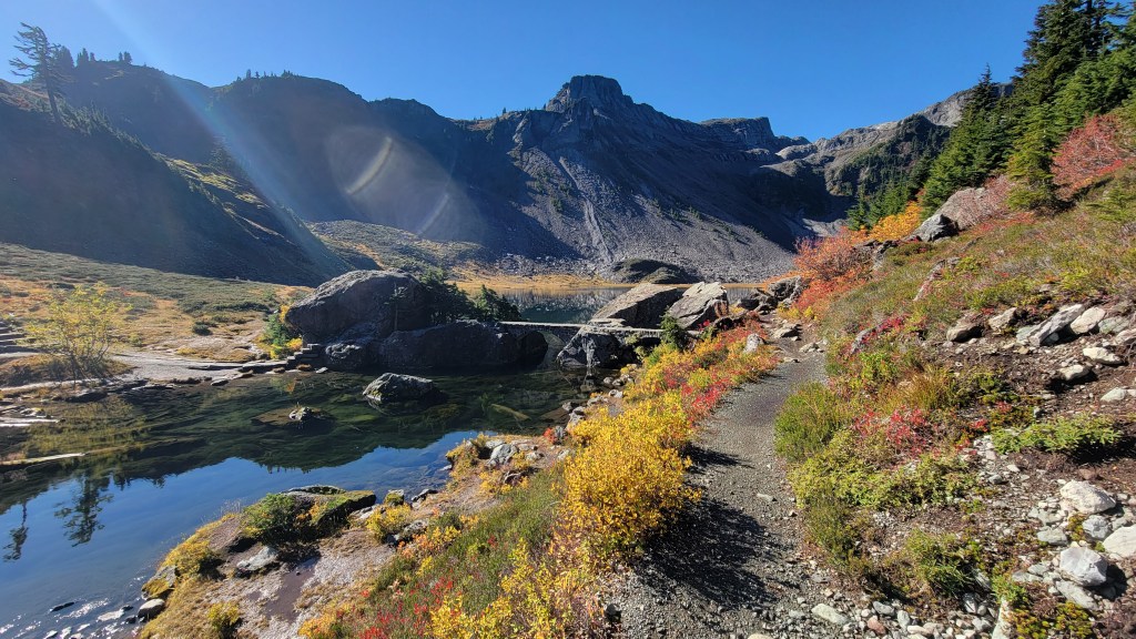
In terms of hikes, the first one you’ll encounter heading east is Easy Pass, which is far from easy, gaining 2800 feet in only 3.5 miles, but allowing backcountry access into the true North Cascades National Park. Next, arrive at Rainy Pass, which provides multiple hiking options, all of which are popular in the summer and draw literally thousands of hikers in autumn. On the east side of the highway, Cutthroat Pass is one of the quintessential autumn hikes in the North Cascades, as the native subalpine larch turns a brilliant blaze of yellow in late September to early October. Across the highway, the Heather-Maple Pass Loop is one of the most-visited hikes in the state during the fall. This past October, parked cars stretched almost 2 miles in each direction beyond the full trailhead parking area, as hundreds upon hundreds of hikers converged at the trail to partake in spectacular views into North Cascades National Park and some brilliant autumn foliage to boot. Though it begins on Forest Service land, the trail does straddle the national park boundary for a short distance near Maple Pass. Down below, shorter hikes to Lake Ann and Rainy Lake offer views and foliage for those who don’t want to tackle the pass, with the latter even being wheelchair accessible. Due to the popularity of these 4 trails, I cannot urge you enough to avoid visiting on weekends, as weekdays will provide better parking and more elbow room.

Farther along, Blue Lake is another very popular autumn draw, offering striking colors with just a little over 2 miles of hiking. Again, try to avoid visiting on weekends.


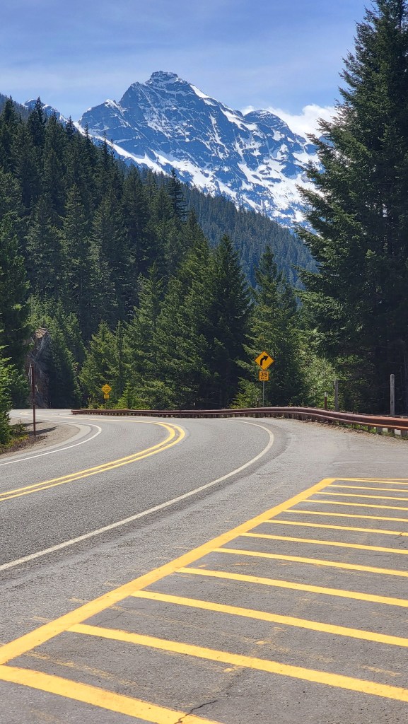
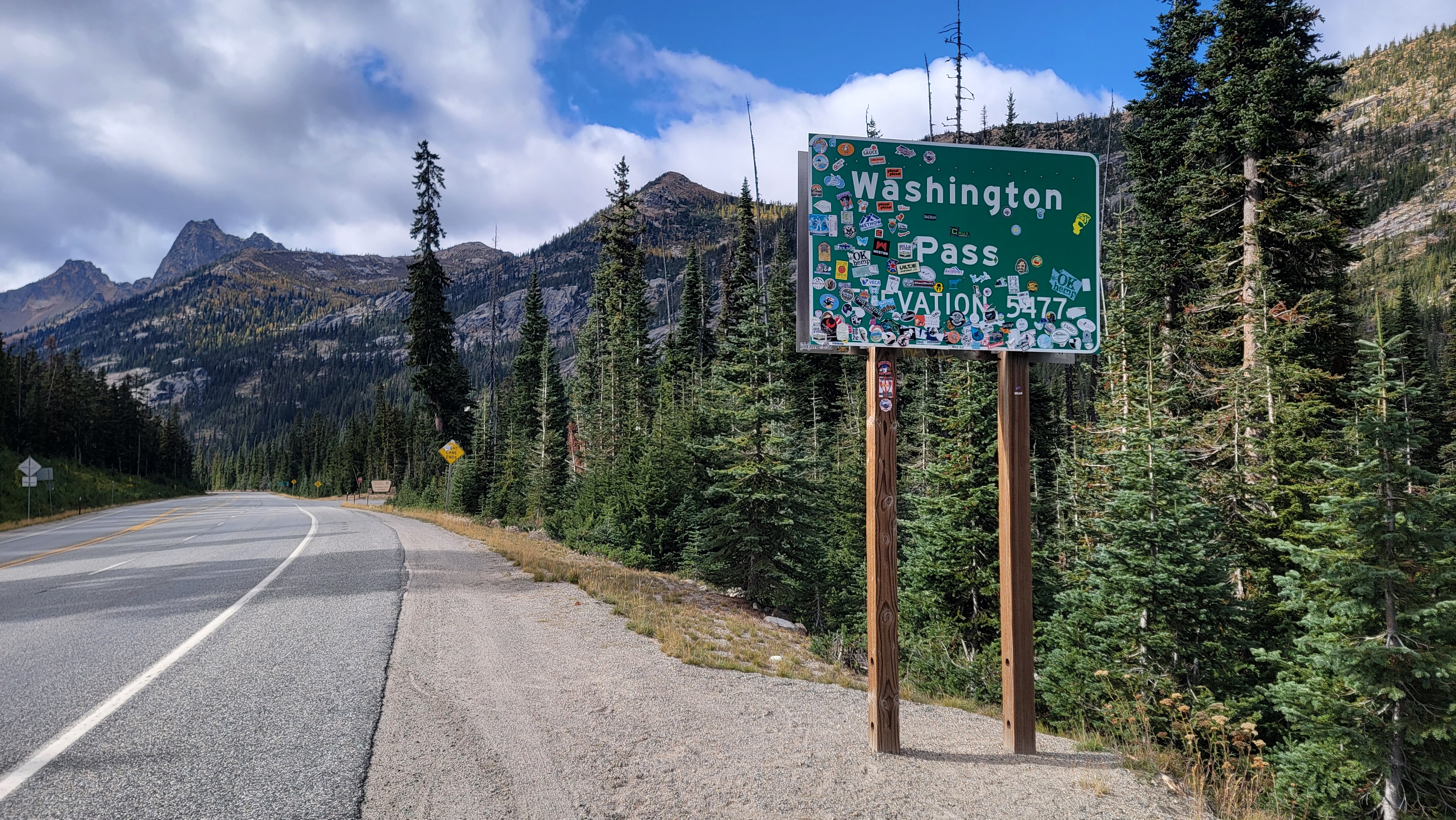
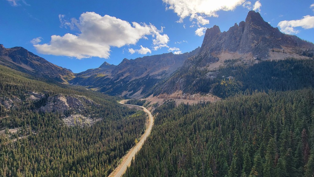
Just a couple miles more, and you’ll reach the high point on the North Cascades Highway, cresting Washington Pass at 5477 feet above sea level. Be sure to take a few minutes and pull into the parking lot, as the gentle and paved paths take you to jaw-dropping views of the surrounding mountains, with Liberty Bell and Early Winters Spire dominating to the west, and the Methow Valley falling away from you to the east. The next couple miles of the highway are some of the most dramatic, so please use pull outs if you wish to take in the view.

After you round the hairpin and start your curve into the Methow, the trail to Cutthroat Lake offers more fall color and a picturesque lake, albeit with quite a bit less exertion than the hikes mentioned above. It also sees a bit lower numbers of hikers than the others, and is a great family-friendly alternative.
Methow Valley
Situated far north and only accessible via Highway 20 from the west or the east, the Methow Valley is more secluded and a bit more rugged than the east slope areas on the other mountain passes, but this doesn’t mean it is free of crowds. During the summer especially, hordes descend for a taste of the old west.
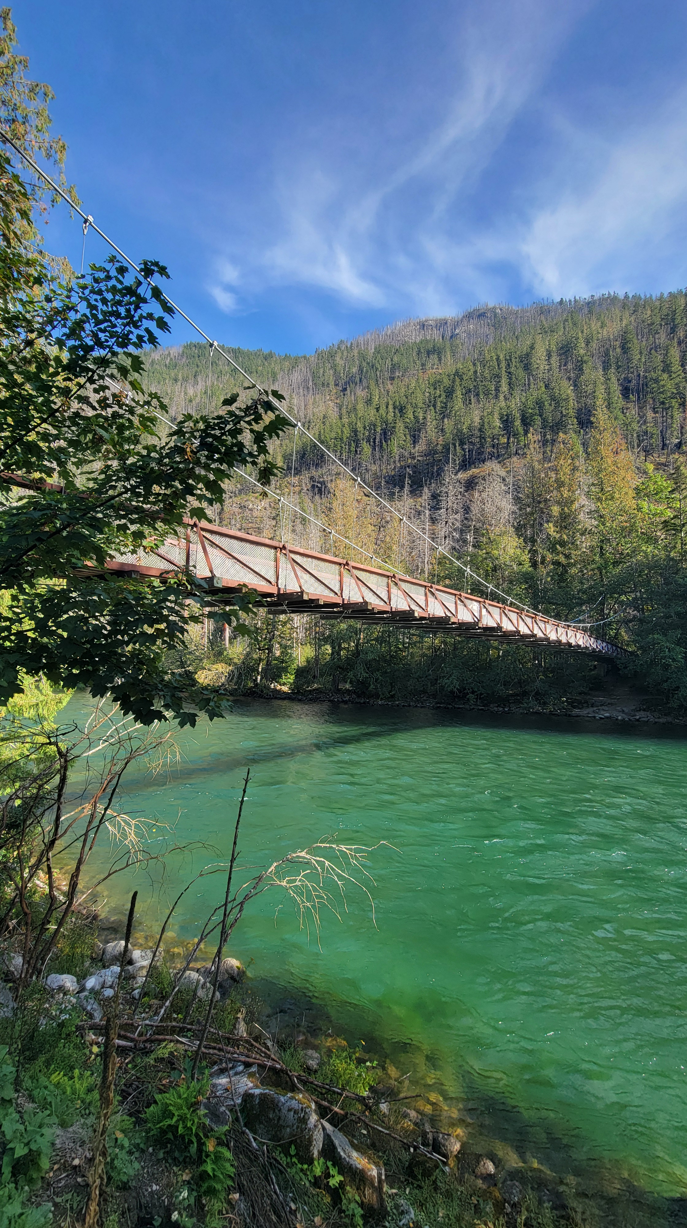
Farthest west, the tiny town of Mazama is a crowd-favorite among locals and travellers alike, with The Mazama Store being regionally famous for, of all things, baguettes! People line up daily to take home one of these flaky and crispy artisan breads, paired with other expertly crafted pastries and so much more. Next door, Goat’s Beard Mountain Supplies will outfit you for hiking, rafting or lounging by the campfire. Nearby, a short trail will take you to the Tawlks-Foster Suspension Bridge, while a longer, bumpier trip will take you to the Goat Peak trailhead, featuring a short but steep climb to an old fire lookout perched at 7000 feet.
Continuing on, Winthrop remains the major draw in the valley, and is somewhere I have visited since I was a child. In the early 1970s, with the anticipated completion of the North Cascades Highway and seeking to capitalize on tourist traffic, the town underwent a massive renovation to turn into a movie-set worthy old west town, featuring false storefronts and wooden sidewalks. Today, the vibe of Buffalo Bill Cody and Calamity Jane continues to draw visitors from all over the country, hoping to take a step back in time and get their cowpoke on.

The town has a lot to offer, but to save space, I’ll highlight a couple of my favorite local spots. For food, I stop at Rocking Horse Bakery for my morning coffee and pastries, East 20 Pizza for classic and unique pies, and Lost River Winery and Methow Cider for an afternoon of sipping. My go-to stores include Trail’s End Books, Pinetooth, Cascades Outdoor Store and Winthrop Mountain Sports. Sheri’s, located at the main 4-way stop, is a family favorite with ice cream cones, saddle seats and mini golf.


In the area, I enjoy camping at Pearrygin Lake State Park for swimming and fishing. If you can, try to score one of the lakefront sites, where you can wade right in with your pole just steps from your tent. In chilly seasons, or if tenting is not your thing, several 1-bed cabins with kitchenettes are available, plus numerous RV sites. For a more upscale stay, try Sun Mountain Lodge up on a ridge west of town, offering stunning views, along with watersports and miles of trails.
South of Winthrop, take a stop in the town of Twisp for a slower-pace visit, making sure to pop in to Cinnamon Twisp Bakery, plus Hometown Pizza, 1908 BBQ & Bourbon, and Last Chance Distilling for a well-rounded culinary day. To work off all the calories, hit up Lookout Mountain, a short but steep hike to a 60-foot high fire lookout offering 360 degree views of the surrounding mountains and valleys.
Northeast Corner
Heading east from Twisp, State Route 20 continues another 216 miles all the way to the Idaho border, passing through remote areas of forest, rolling hills, farm country and small towns. I have not been to some of these areas in several years, and other portions I have never traversed, so the remaining information in this section will be purely informational, and not based on my personal experience.
Climbing once again, State Route 20 reaches an elevation of 4020′ at Loup Loup Pass, home to a popular local ski hill, Loup Loup Ski Bowl, featuring dry powder, short lines and cheaper tickets than the corporate-owned resorts closer to Seattle. As the highway reaches US Highway 97, come to sister towns of Okanogan and Omak, residing along the Okanogan River. Omak is renowned nationwide for it’s annual Omak Stampede rodeo, which just marked its 91st year, and features the “Suicide Race,” in which riders take their horses 225 feet down a steep bluff to the river, swim across and run to the finish line.
Farther north up the joint SR 20/US 97, the small town of Tonasket marks the point to head east once again. I have never been to Tonasket, however, my wife and her sister visited a college friend from there once again, and can only describe the area as the true west, featuring large cattle ranches, and people who actually wear boots and western shirts as part of their everyday attire.
The next traverse of the highway features long stretches of unpopulated forest, with hiking trails and Sherman Pass, the highest maintained pass in the state of Washington, at 5575′. Drop back down out of the hills, and cross the mighty Columbia River, at this point better known as Lake Roosevelt, and part of the upper portion of Lake Roosevelt National Recreation Area. The town of Kettle Falls is on the east side of the lake. My only experience in this area came during high school, when I was part of a 50-mile canoe trip with my Boy Scout troop, camping different nights at both Summer Island and Kettle River campgrounds near Kettle Falls.
Beyond this point is completely untraveled by me, but features a long stretch of remote and sparsely-populated areas up through the Colville National Forest and then down along the Pend Oreille River to the Idaho border at Newport. As with so many places I have yet to visit, this portion of the state is on my list.
Go West, Young Man
Back the other direction from Marblemount, Highway 20 winds westward into the lower Skagit Valley, with plenty more to see. Between mile markers 97 and 96, Rockport State Park offers 3 separate easy 1-mile hikes, and provides a unique place to see a rare ecosystem with 250-foot tall old-growth trees. Sadly, some of these trees have begun contracting a wasting disease that makes them more prone to falling, so camping has been prohibited for several years. For those wanting to camp, nearby Howard Miller Steelhead Park does offer year-round campsites.
For another great hiking option, at milepost 96, find the turnoff to access the trail to Sauk Mountain, a short, steep and narrow hike that features views from the moment you reach the parking lot. Wildflowers abound in early summer, and the trail is often nearly free of snow by late June. The road up is long, steep and bumpy, but usually passable for standard cars.
A few minutes farther west rests the historic town of Concrete. Officially incorporated in 1909, the town grew around 2 settlements built by local Portland Cement companies, straddling the scenic Baker River. Long past the days of cement operations, Concrete still features large free-standing concrete silos and numerous other historic buildings. Take a moment to walk across the Henry Thompson Bridge, which was the longest single-span reinforced concrete bridge in the US when it was completed in 1918.
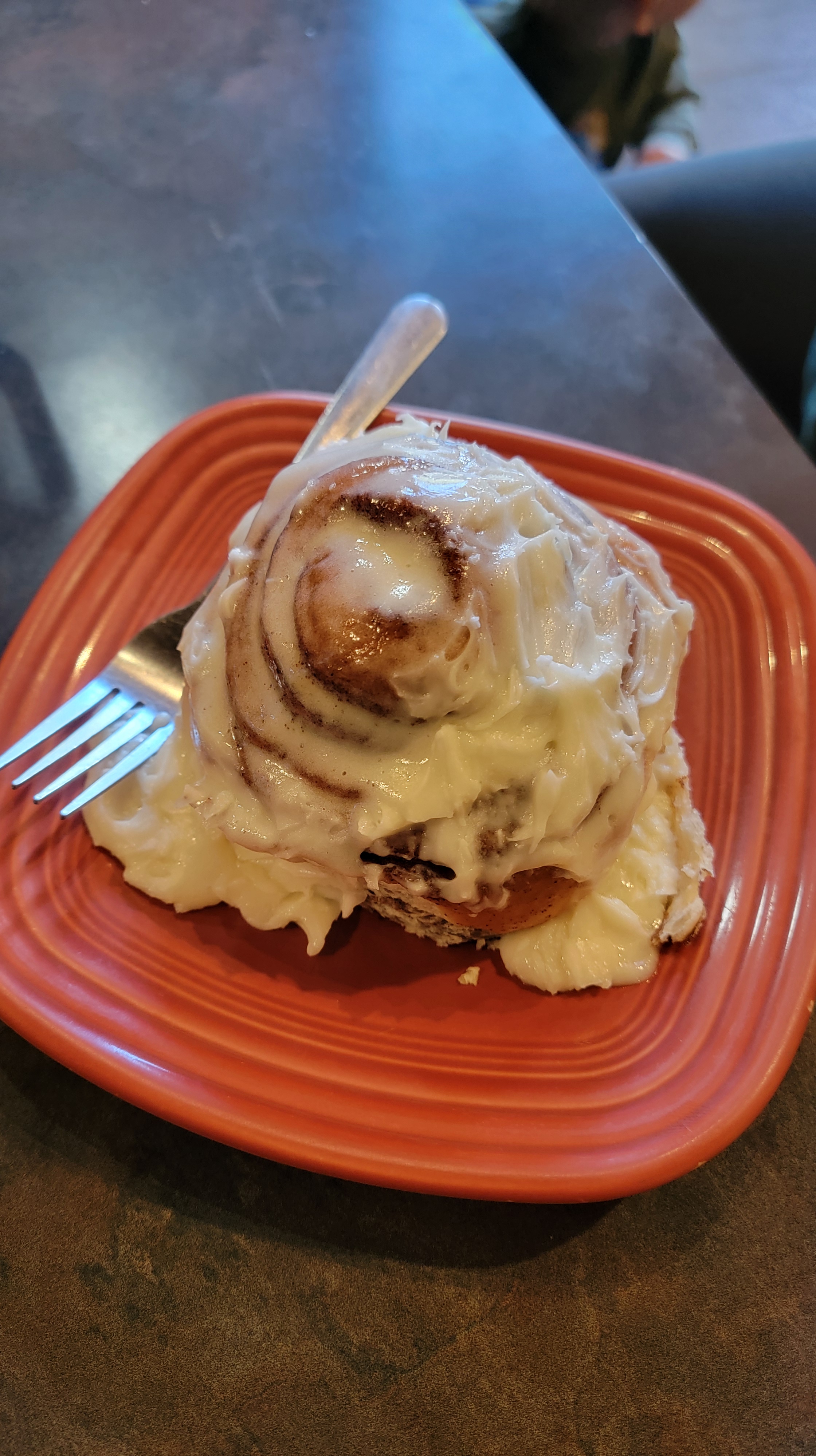
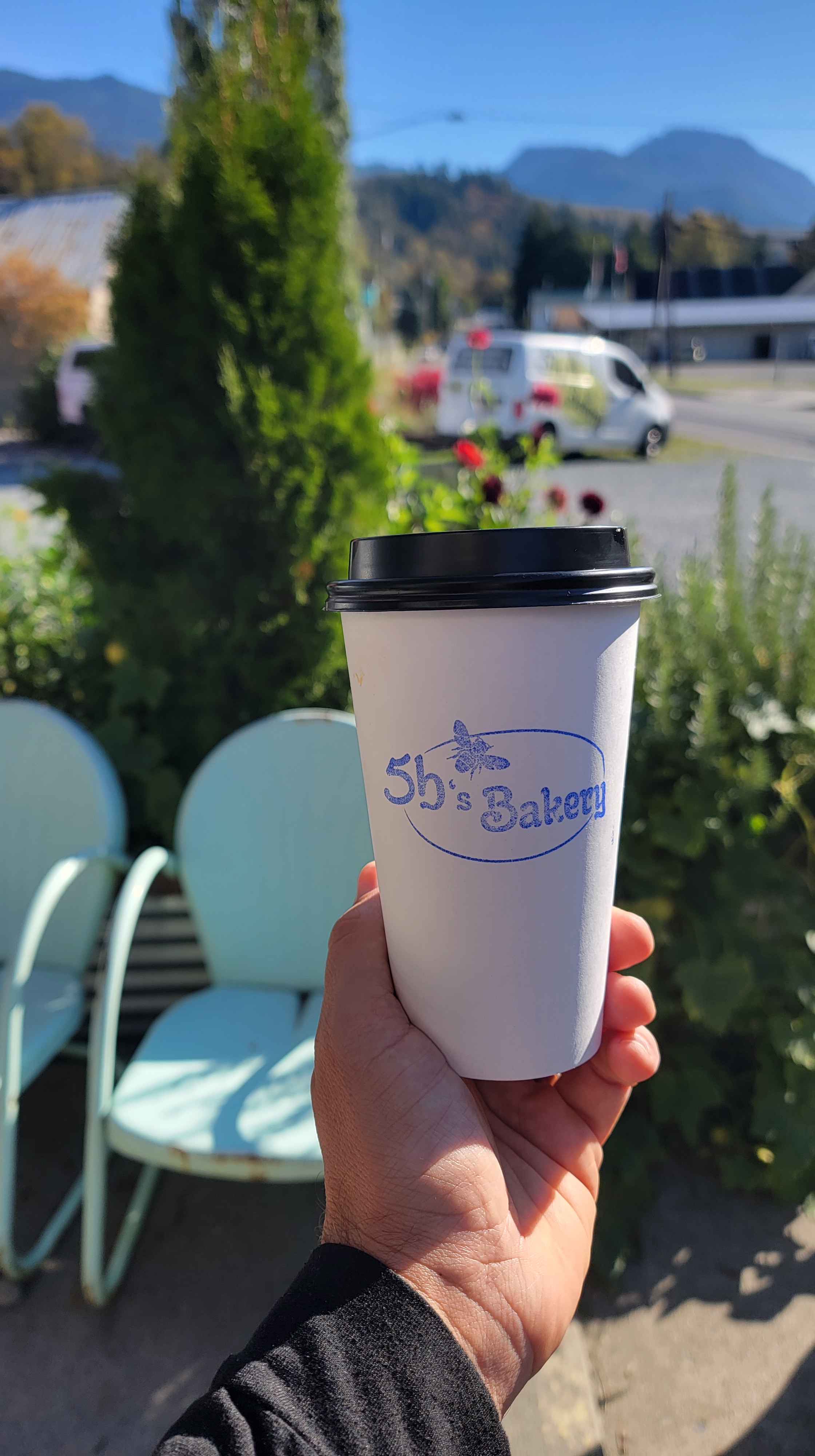
In town, local treasures include 5B’s Bakery, one of the only fully gluten-free bakeries in the northwest portion of the state. Stop in for a gooey cinnamon roll or an almond croissant to enjoy on the garden patio. Back along the highway, Cascade Burgers serves up classic diner-style burgers, fries and milkshakes, while Act One Ice Cream Parlor on Main Street hits the spot with cones, sundaes and affogatos.
Another historic, but currently functioning, relic of Concrete is the Lower Baker Dam, just north of town. At 293 feet tall, it was the highest hydroelectric dam in the world upon completion in 1927. Behind the dam, Lake Shannon is a popular local spot for recreation, with fishing and boating access. During summer months, local outfitters rent out kayaks and paddleboards for day use.
A few miles west again, reach the community of Birdsview. With only a couple businesses, Birdsview is a great pit stop for gas, food or a beer. Touting itself as the best burger stop along the river, Birdsview Diner features both standard burger fare and unique offerings like the Blackberry Bacon Burger or the Piggy Back, packed with BBQ pork and Mac ‘n Cheese. The diner also has periodic live music on weekends. For a post-burger beer, hop another couple minutes west to Birdsview Brewing, a small craft brewery with a standard palette of IPAs, wheat beers and some darker pours too.
Baker Lake
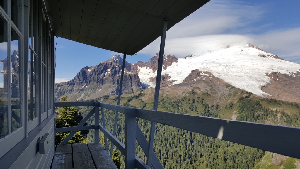
In the middle of Birdsview, the turnoff for Baker Lake Road opens up to an array of outdoor recreation options. In total, the road runs for 26 miles, 20 of which are paved. Along the way are several USFS campgrounds, plus numerous trailheads, and access to Baker Lake, which features scenic views of Mount Baker towering to the north. My favorite hike in the area is Park Butte, featuring a historic fire lookout with a stunning view of Mount Baker. I love this spot so much I even have an old piece of the lookout from when the shutters were being replaced several years ago that I carried the entire 3.5 miles back to the trailhead.
Other great hikes include Anderson and Watson Lakes (6.0 mi RT, 1100’ gain), Shannon Ridge (8.2 mi RT, 2800’ gain), Dock Butte and Blue Lake (4.4 mi RT, 1500’ gain), and Baker Lake (8.0 mi RT, 500’ gain). This last one is a great option year-round, as it remains low enough elevation to stay snow-free much of the winter.

Genuine Skagit Valley
Down in the Skagit lowlands, a robust community of farms, food, arts and outdoor recreation thrives. The first town you’ll hit when coming from the North Cascades is Sedro-Woolley, which combined two rival towns bearing those names in 1898. For the first part of the 1900s, the town thrived on logging, coal mining, and the presence of 3 railroads. Later, it became the home of the Northern State Hospital and a steel mill, while today aerospace is the main employer.
Along State Route 20, the National Park Service and US Forest Service operate a joint visitor service center, which also serves as the park headquarters. Popular food options in Sedro-Woolley include Double Barrel BBQ (with hand-rubbed and slow-roasted meats), Joy’s Bakery (with an array of baked treats plus breakfast favorites), Hal’s Drive-In (with all the 50s diner staples), and Skagit Valley Burgers Express (try the deep-fried Oreos for dessert). For morning donuts, the local Food Pavilion grocery store sells surprisingly good rise donuts and fritters.
Today, part of the old Northern State Hospital campus is open for hiking along farm trails, providing viewing of some of the historic buildings. For a less-eerie way to spend a Saturday, opt instead for a tasting at Eagle Haven Winery or high tea at Willowbrook Manor.
Once you hit the Interstate 5 corridor, neighboring cities Burlington and Mount Vernon have just about everything you need, including Costco and Walmart, plus a lot of other big box retail. In terms of food, there are far too many options to list, but a few of my favorites are Train Wreck Bar & Grill, The Fairhaven, Swan’s Korean Fried Chicken, Temperate Habits Brewing, Il Granaio Italian and District Brewing. For lodging, Burlington offers a few locally-owned options plus several large corporate chain hotels. Two of my other favorite Burlington stops are the roastery for Fidalgo Coffee (outlet store open Saturdays), and Fairhaven Mill (home to locally-sourced, organic flour and grains).


Saturdays in Mount Vernon feature a lively farmer’s market along the river walk, while the Lincoln Theater hosts a variety of regional musical acts as well as popular live theater performances. Also downtown, the Skagit Valley Food Co-Op is my go-to for health food choices, a great beer selection, local meats and seafood, plus gifts and treats (no membership required to shop!).
For great nearby hiking, hit the numerous trails at Little Mountain Park, encompassing 522 acres of forestland and more than 10 miles of trails (if you’re short on time, or other factors prevent a hike, you can drive to the overlook at the top of the mountain).
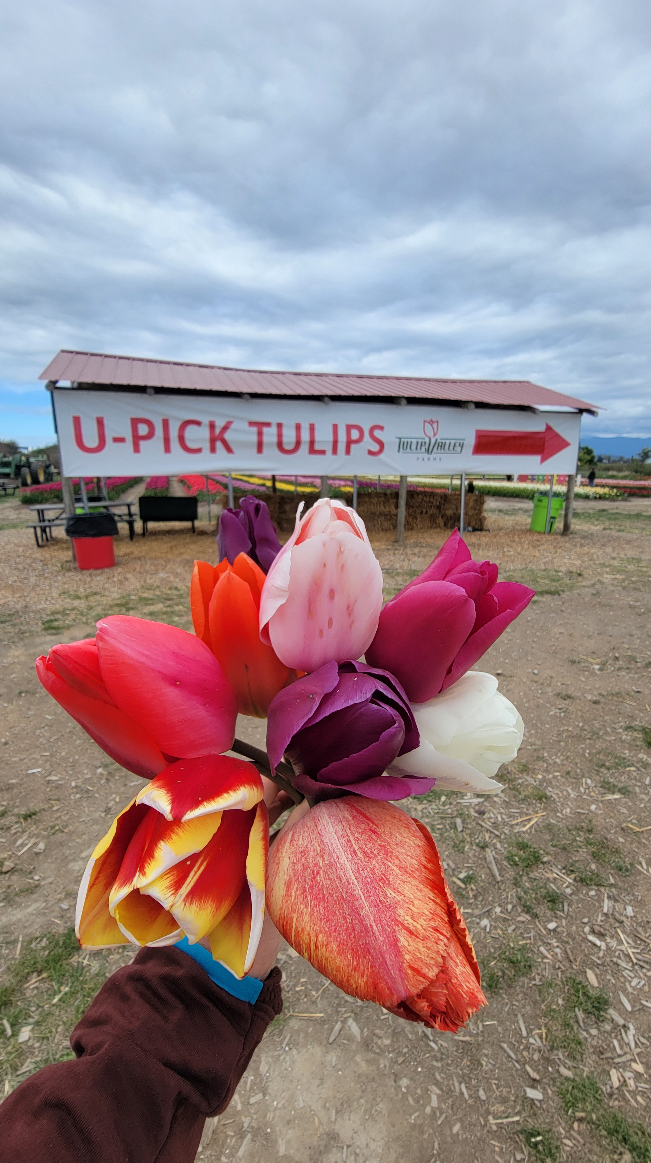
Mount Vernon is also well-known for the annual Skagit Valley Tulip Festival each spring, drawing thousands of visitors to admire countless tulip and daffodil blooms on several local farms. Read about my favorite farm here.

Samish & Swinomish Flats
To the west of Mt. Vernon are a couple of my favorite local areas to visit, no matter the season. To the Northwest, the tiny towns of Bow and Edison might be short on people, but tall on regional cuisine and local goods. Accessible from either exit 236 off Interstate 5 or via State Route 11 (also known as Chuckanut Drive), the towns fall on either side of SR 11. To the east, Bow is home to the popular Bow Hill Blueberries, an organic farm with numerous blueberry items available in their farm store year round, plus U-Pick blueberries on weekends in mid-summer. Along with fresh or frozen berries, be sure to grab a bottle of heirloom blueberry juice or some blueberry marinade and salad dressing!
At the intersection of Bow Hill Road and Chuckanut Drive, take your pick of food, depending on your mood. On the NW corner sits Brando’s BBQ, one of the highest-rated local barbecue joints. If you have a hard time picking an item off the menu, just go for the BBQ Sundae, with baked beans, mashed potatoes, mac n’ cheese, pulled pork or brisket, slaw and sauce all in one giant cup. For standard American fare, hop across the highway to The Rhody and its adjoining Farm to Market Bakery, where you’ll find exquisite lunch and dinner options featuring locally-sourced veggies, meats and seafood. For elevated cuisine, one more skip across the road to the south brings you to cob + cork, with 3-course chef’s dinners and champagne brunch.
Also in the area, be sure to stop by Samish Bay Cheese for some curds and whey. All-organic and sold fresh from crafting, my favorite varieties include Ladysmith with Chive, Queso Jalapeno and Nettle Gouda. If lactose is not your friend, nearby Harmony Fields offers cheese made from sheep’s milk!
Nestled along a slough just steps from the Samish Bay tideflats, the small but lively town of Edison goes big on the food scene. With numerous highly-rated local stops, you’re sure to leave with a full belly and wanting to come back for more. For pastries and breads, a stop at Breadfarm is a must, while Terramar Brewstillery is a must-stop on the other end of the day, with rich craft liqueurs and funky beers, plus excellent pizza and a spacious beer garden. Other delicious options in town include Tweet’s, Slough Food, Mariposa and The Edison Cafe. Not too far from Edison, True North Bakery and Chuckanut Brewery are great stops adjacent to the regional airport.

Just a few minutes further north on SR 11 are two of my other local favorites. Chuckanut Manor is a great local option for seafood, with a flavorful PNW cioppino, clam fettuccine, and rich clam chowder. I’m also fond of their weekend brunch, plus the cinnamon roll bread pudding for dessert. For drinks, I especially love the Lavender French 75 and the Skagit Mule. The sunset views are unbeatable as well. The other must-stop for seafood lovers is Taylor Shellfish Farms, with an oyster bar and a seafood market right on the beach.

Hopping south and west, the quaint town of La Conner finds me visiting several times a year. A long and curving main street hosts numerous shops, galleries and restaurants, with those on the west curb perched above Swinomish Channel. Stroll the boardwalk above the boat slips for views of the Rainbow Bridge and to enjoy some great local options, ranging from books to yarn, antiques to outdoor clothing.

For food, my favorite in town is La Conner Seafood and Prime Rib, which is an especially great option on warm summer evenings as you enjoy some prime rib and fresh catch on the channel-side patio. For a relaxing afternoon or evening, I like to stop by La Conner Brewing for a pint of Nitro Maestro with Madagascar vanilla bean or the Raspberry Wheat. When I’m not up for a full sit-down meal, I stop at Tunnie’s Fish & Chips, where the cod and halibut are perfectly breaded and fried, being rich but not heavy and greasy. The house-made tarter with sriracha is excellent on the fries as well as the fish, and the chocolate mint waffle shake is the perfect dessert.
Anacortes and the San Juan Islands
Located on Fidalgo Island at the end of a spur of SR 20, Anacortes is a thriving sea town, with a large marina, a fleet of fishing vessels, and multiple ship building and boat repair businesses. Downtown offers walkable shops and places to eat, while the marina offers an extensive walkway along the water, and hosts a farmer’s market on summer Saturdays.
Before you reach Anacortes, be sure to take a quick detour from the highway and grab a cone or a pint to go from Lopez Island Creamery, where everything is made from scratch in small batches. Once you reach town, the aptly named The Store in Anacortes has what I consider to be the best muffins in the entire country, and I’ll fight anyone who says otherwise. I’ve been going here for muffins for almost 10 years, and have yet to find anything that compares at any other bakery.
South of town, the Anacortes Community Forest Lands is a protected area of over 3,000 acres of mid-growth woods and over 50 miles of trails, leading to lakes and viewpoints. I have hiked numerous times in the park and still have not logged every mile of trail. For more information, check out my Anacortes Community Forest Lands article here. Another great outdoor option is the Washington Park loop road, near the ferry terminal for the San Juan Islands. Accessible by car, bike or foot, the loop road traverses about 2 miles around the perimeter of a forested peninsula, and features stunning views of the channels below. It is a great spot to view whales and porpoises, plus deer and eagles. In the distance, spy the San Juans and the Olympic Mountains. The park also features a campground with 68 sites, a boat launch, play area, and beach.

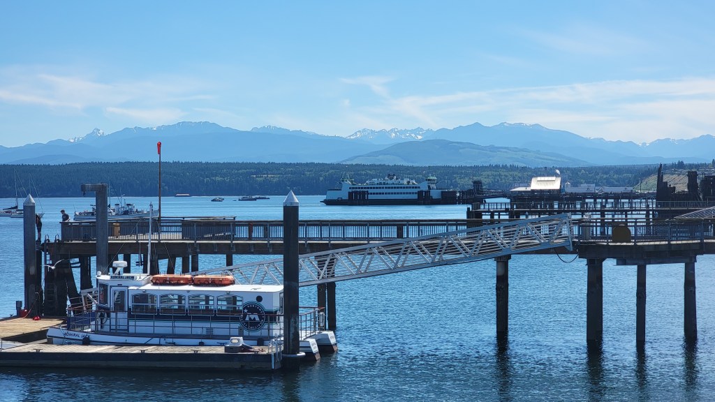
For the San Juan Islands, you can reach them by Washington State Ferry out of Anacortes or by float plane from Kenmore Air out of a few places near Seattle. For the ferry, reservations are strongly advised, and in the summer, it is nearly impossible to get on a sailing via standby. Schedules and fare information can be found on the Washington State Ferries website.
Of the islands, San Juan and Orcas are the 2 most popular, while Lopez and Shaw offer slower-paced visits. Each has many unique features and places to offer, so it all depends on if your trip is going to be centered around seeing the sights, hiking, good food, or relaxing beaches. I have put together a comprehensive overview of a long weekend visiting 3 of the islands, which you can read here. This article was also published in Washington Trails Magazine last summer.

Deception Pass and Whidbey Island
Growing up, my family spent a lot of long weekends throughout the year on Whidbey Island, and I developed a deep love for it that persists to this day. With its combination of beaches, seaside towns, farms, trails and historic sites, Whidbey Island really has it all. Combine that with proximity to the Seattle metro area, and it is an unbeatable day trip or weekend destination for visitors and locals alike.
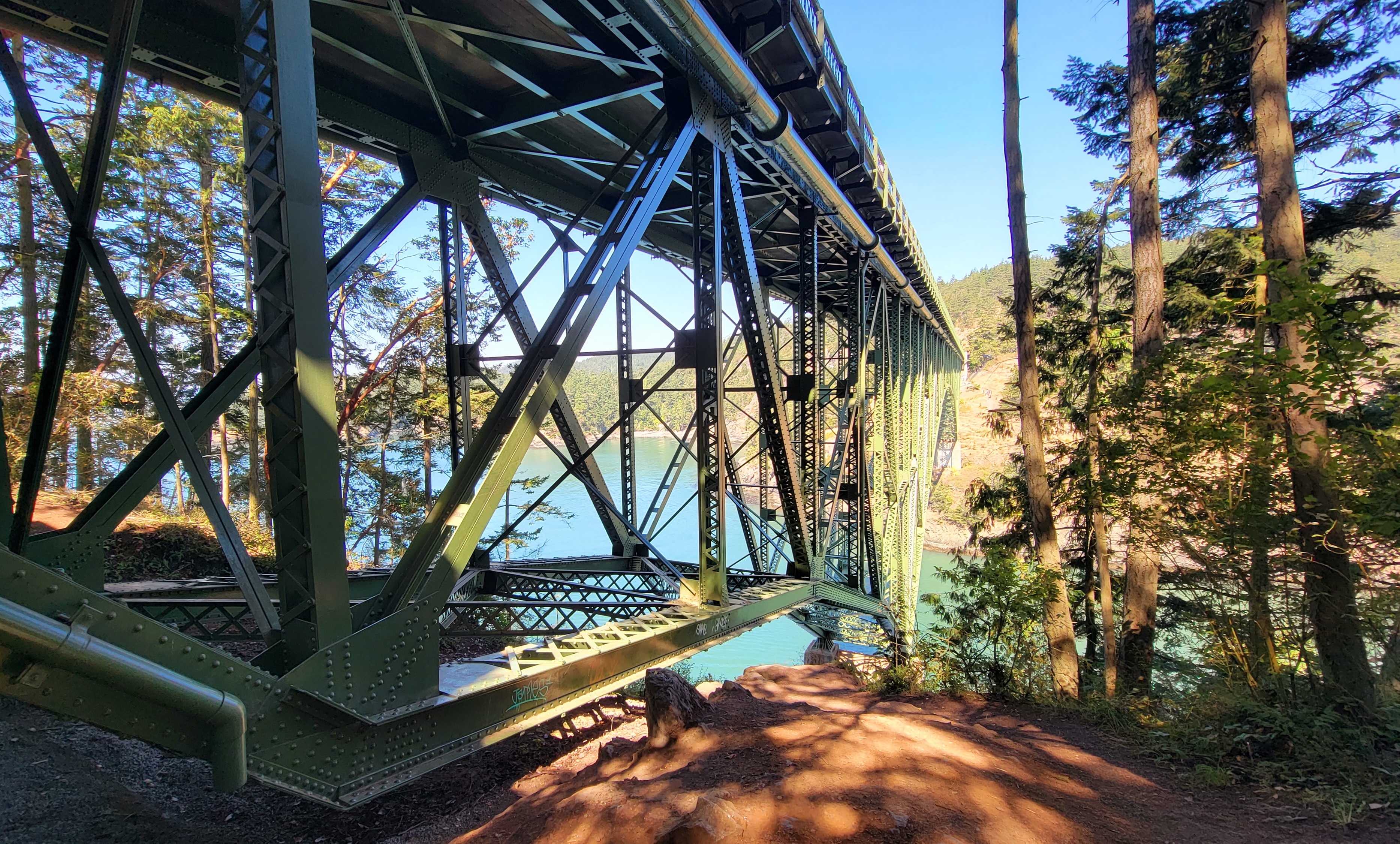
Though often reached via ferry on the south end of the island by visitors coming up from Seattle, if you’re on State Route 20, you’ll be more likely to access the island via the north, crossing the stunning Deception Pass bridge. Completed in 1935, with 1487 total feet of bridge length spanning two turbulent channels, the bridge is one of the most photographed landmarks in the area. If you’re brave enough, consider parking at one end of the bridge and walking across, roughly 180 feet above the water level.
Encompassing most of the land on either end of the bridge, Deception Pass State Park is one of my favorite parks, and is popular for hiking and beachcombing year-round, plus camping, swimming and fishing. One of my go-to hikes is Rosario Head/Lighthouse Point (5.0 mi RT, 350’ elev gain) with a scenic combination of rugged coastal cliffs, sandy beaches, coniferous forests and views of the bridge, while my second favorite is Goose Rock (4.3 mi RT, 384’ elev gain) which is one of the most stunning spots to watch the sunset, offering uninterrupted 180 degree views of the Salish Sea, San Juan Islands, and Whidbey Island. To the south, you may even see some of the U.S. Navy EA-18G Growlers, stationed in nearby Oak Harbor.
A few miles to the south, Oak Harbor is the largest town on the island, with a population of about 25,000. A true military town, a large portion of the residents are either stationed at the Naval Air Station, or are civilian employees working there (Ask any of the airmen you encounter, and they are likely to send you to Jumbo Burrito for some of the best Mexican street food with tacos, sopes, tortas and so much more).
Near the center of the island, Coupeville is the second oldest town in Washington State (originally laid out in the 1850s), and is full of historic homes, plus a quaint waterfront Main Street. At the east end of the businesses on Main resides Molka Xete, one of the best places I’ve been for Mexican food. Be sure to wander the stores lining both sides of the road, and take a stroll out to the end of the historic wharf. For baked goods, stop at Little Red Hen Bakery, and for coffee, Sunshine Drip.


Just a few minutes east of town, the Price Sculpture Forest is a great stop for kids and art lovers. A privately-owned preserve, the forest features multiple large and elaborate art installations set about a total of 0.6 miles of trails, suitable for all ages. The upper loop is built to ADA guidelines, and generally usable by wheelchair or mobility scooter (unless it has recently rained).


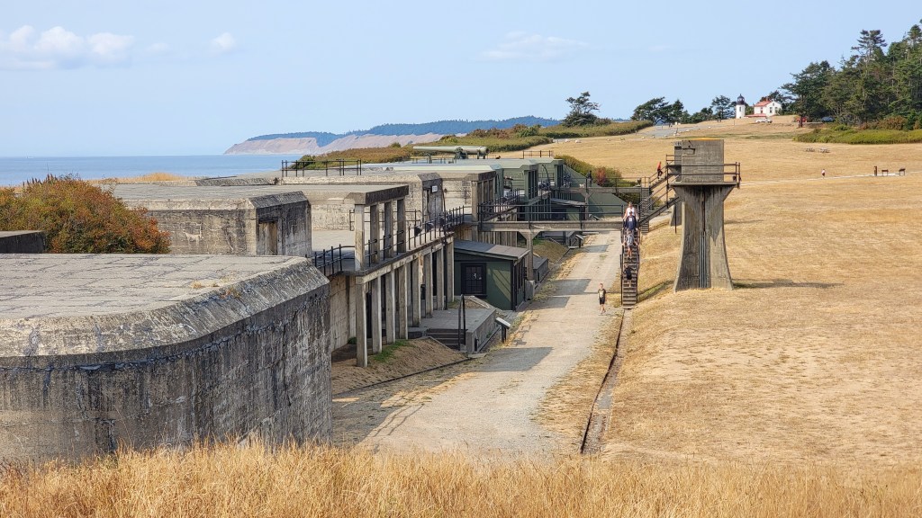
Another kid- and adult-approved local place to explore is Fort Casey State Park, somewhere I have gone nearly every year since about age 10. With 999 acres of land encompassing a World War I army fort, the park is one of the most popular destinations on the island, and gets crowded on summer weekends. Take ample time to wander the historic structures, pose for photos by the large cannons, and climb to the top of the tower at Admiralty Head Lighthouse. The park also has 1.8 miles of trails, plus 35 campsites right above tide level at Keystone Harbor, with up-close views of the Washington State Ferry landing, plus beach access.

Though operated by the State of Washington, Fort Casey and Coupeville both fall within the greater Ebey’s Landing National Historical Reserve, featuring other nearby historic sites and more hiking and beach options.
Before heading west across Admiralty Inlet, take a detour a little farther south to the town of Greenbank, home to Meerkerk Gardens, with 10 acres of display gardens, 43 acres of woodlands, and over 2 miles of trails. The most popular time to visit is spring when the enormous rhododendrons explode with showy blooms, but the gardens are pretty any time of year. Read all about our springtime visit here.


Port Townsend & Beyond
Though many people (locals included) do not realize it, State Route 20 actually crosses over the Salish Sea all the way to the Olympic Peninsula. The ferry route from Whidbey Island to Port Townsend is considered a continuation of the state highway, and it continues quite a few miles further until it terminates at US 101. On the Quimper peninsula and nearby Marrowstone Island offer great outdoor recreation and other touristy things.
One of the oldest towns in Washington State, Port Townsend was incorporated in 1851, with visions of becoming the area’s premiere seaport. Today, the primary economy is tourism, with the historic downtown being a major draw. With shops, coffee, food and waterfront access, the stroll along the main street is always enjoyable. A little out of town, Fort Worden State Park is a popular spot for camping and beachcombing, plus exploring the remains of the World War I military installation. Just a short drive away, Fort Flagler on Marrowstone Island completes the Triangle of Fire with Forts Worden and Casey, and the state park there also offers camping, hiking, and beach access.


For more information on spending a few days in the Port Townsend area, check out my recap of our long weekend at Fort Flagler State Park here.
Bonus Side Trips:
Mt. Baker Highway
Though not connected to State Route 20, and a decent drive away from it, State Route 542, also known as the Mount Baker Highway, is another popular entrance to the North Cascades, utilized year-round by locals and visitors to reach spectacular views of mountain peaks, breathtaking hiking vistas, and winter sports.
The highway extends 58 miles from Bellingham, terminating at Artist Point at an elevation of 5100 feet. During the winter, the final 2.7 miles of the roadway is closed to vehicles, and often doesn’t reopen until June due to deep snow (the nearby Mount Baker ski area averages 641 inches of snow each winter). At the parking lot, visitors can enjoy epic views steps from their cars, or embark on a number of scenic trails offering a range of distance and elevation gain, but all featuring stunning mountain views, along with vibrant autumn foliage. My favorite options are Ptarmigan Ridge (9.0 mi RT, 1800’ gain) and Table Mountain (2.6 mi RT, 725’ gain). Starting a bit lower on the highway, I also love Lake Ann (8.2 mi RT, 2150’ gain) and Chain Lakes Loop (6.5 mi RT, 1820’ gain). It’s hard to go wrong with any trail in the area, but be aware they all are very popular and see large crowds during the short window of accessibility in summer and early fall. Mount Baker Highway also offers numerous other hiking options along nearly its full length, so check the Hike Finder Map on the Washington Trails Association website for the full menu.


On your way to and from Artist Point, there are a couple must-stops. First thing in the morning, you’ll need coffee and a pastry, and the best place for these is Wake ‘n’ Bakery in the tiny town of Glacier, with organic coffee and handmade baked goods, many of which are gluten, dairy or sugar free, or are made with local or sustainable ingredients. After your hike, every SR 542 trip calls for a stop at North Fork Brewery, one of my favorite local places for giant pizzas and grinder sandwiches, plus a range of unique beers. From standards like hefeweizen and IPA to less-common offerings like scotch ale and ESB, to robust and unique sour beers (I’ll never forget how surprisingly tasty the pickle sour was a few years back), North Fork is sure to have something for every beer drinker.

Lake Chelan
One more bonus destination nearby is Lake Chelan. Located a little over an hour south of Winthrop on State Routes 153 and then 97, Chelan is a popular getaway for Western Washingtonians during the warm months. The lake itself offers ample recreation opportunities and is popular for boating, fishing and camping. Several hikes are also within close proximity to town, ranging from a gentle hike along the Chelan River or a strenuous hike up a desert mountain (both accessible from the Chelan Butte trailhead just outside of town). About 15 minutes west of town on the south side of the lake, Lake Chelan State Park has some of the coolest campsites in the state, many with lake views and some with boat docks.


The Chelan region is also a very popular wine region, drawing wine enthusiasts from all over the state and country for tastings, bachelorette parties, seasonal events and live music. With over 40 wineries in the area and over 200 acres of grapes, every wine drinker is sure to find several that hit the spot. Many tasting rooms are on scenic estates with panoramic views of the lake and the surrounding hills.
For food, some of the best authentic Mexican food I’ve ever eaten is at Tacos el Guerro on the east end of downtown, while Lake Chelan Artisan Bakery is always on my list for breakfast sandwiches and cinnamon rolls. After a long day of playing at the lake or in the hills, I love getting a sunset burger and a bucket of fries from the 68-year-old Lakeview Drive In.


Chelan is also the gateway to Lake Chelan National Recreation Area, part of the greater North Cascades National Park Service Complex, and only accessible by boat, plane or foot. At the far north end of the lake, the tiny community of Stehekin has no roads connecting it to any other town, not to mention no cell service! Food and lodging are very limited, but outdoor enthusiasts flock to the town to access popular backcountry and wilderness hiking areas. Most people reach Stehekin via the Lady of the Lake, with daily boat trips from Chelan to several stops up the lake, reaching Stehekin in about 2 and a half hours. The NPS Golden West Visitor Center is currently closed, so be sure to look up hiking information before heading up the lake.
So there you have it, everything you’ve ever wanted to know about spending an endless amount of time traversing Washington’s State Route 20. But there’s even more still to find beyond what is in this article, so get out there, explore, and let me know what you find!
All photos and content © Eric S. Allan 2017-2025

Leave a comment